Category:Bergkirche Pitten
Jump to navigation
Jump to search
| Object location | | View all coordinates using: OpenStreetMap |
|---|
| This category shows the protected monument with the number 55326 in Austria. (Commons, de, Wikidata) |
church building in Lower Austria, Austria  St. George's Church in Pitten | |||||
| Upload media | |||||
| Instance of | |||||
|---|---|---|---|---|---|
| Named after | |||||
| Location | Pitten, Neunkirchen District, Lower Austria, Austria | ||||
| Architectural style | |||||
| Heritage designation | |||||
 | |||||
Media in category "Bergkirche Pitten"
The following 19 files are in this category, out of 19 total.
-
 Altar Bergkirche, Pitten 2022.jpg 2,268 × 4,032; 3.21 MB
-
 Bergkirche Pitten, 2022, Westfassade.jpg 2,268 × 4,032; 4.07 MB
-
 Bergkirche Pitten, Glockenträger 2011.jpg 3,024 × 4,032; 3.87 MB
-
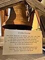 Bergkirche Pitten, Große Glocke 1922.jpg 3,024 × 4,032; 3.57 MB
-
 Bergkirche Pitten, Niederösterreich.jpg 2,268 × 4,032; 2.99 MB
-
 BergkirchePitten.jpg 4,519 × 3,013; 3.07 MB
-
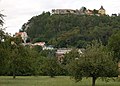
 Burg Pitten.JPG 4,288 × 2,848; 5.56 MB
-
 Duchgang Bergkirche, Pitten 2022.jpg 2,268 × 4,032; 2.98 MB
-
 Felswand Bergkirche, 2022.jpg 2,268 × 4,032; 4.64 MB
-
 Pitten - Bergkirche.JPG 4,600 × 3,660; 9.42 MB
-
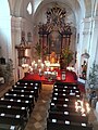 Pitten Bergkirche Innenraum.jpg 3,456 × 4,608; 3.95 MB
-
 Pitten Bergkirche Pedal- und Nebenwerk.jpg 4,608 × 3,456; 3.9 MB
-
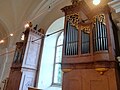
 Pitten Bergkirche Prospekt.jpg 4,608 × 3,456; 3.12 MB
-
 Pitten Bergkirche.jpg 1,200 × 900; 358 KB
-
 Pitten Burg und Bergkirche.JPG 1,813 × 1,294; 662 KB
-
 Pitten Positiv Prospekt.jpg 337 × 599; 32 KB
-
 Pitten Spieltisch2.jpg 337 × 599; 39 KB
-
 Pitten St. Georg Hauptwerksgehäuse.jpg 561 × 599; 54 KB
-
 Pitten St. Georg Pedalwerk.jpg 337 × 599; 30 KB


