File:Arbesbach - Burgruine (b).JPG
Jump to navigation
Jump to search
Size of this preview: 800 × 564 pixels. Other resolutions: 320 × 225 pixels | 640 × 451 pixels | 1,024 × 721 pixels | 1,280 × 902 pixels | 2,560 × 1,803 pixels | 5,240 × 3,691 pixels.
Original file (5,240 × 3,691 pixels, file size: 15.31 MB, MIME type: image/jpeg)
Captions
Captions
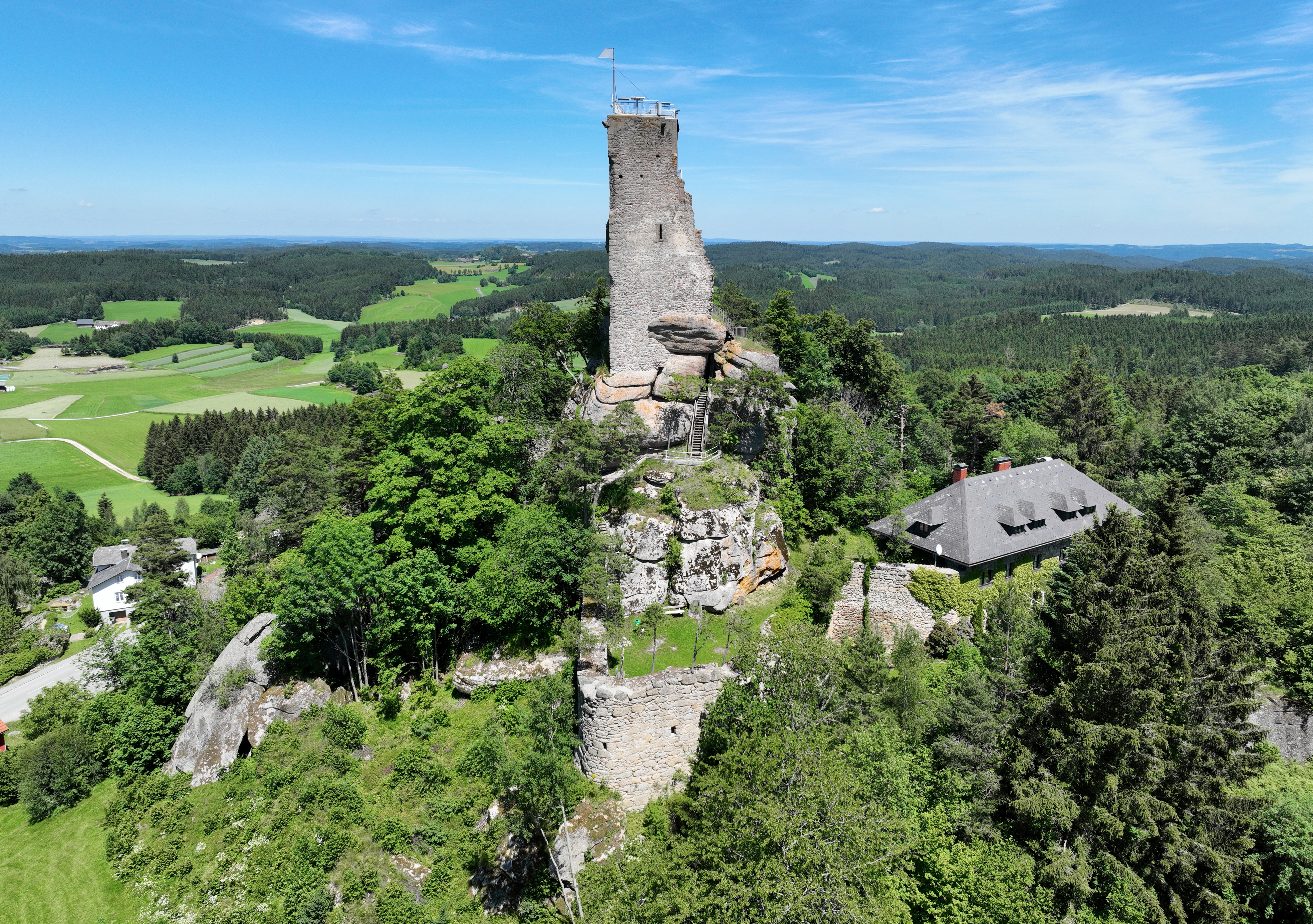
Southwest view of Arbesbach Castle in Lower Austria.
Summary[edit]
| Description |
Deutsch: Südwestansicht der Burgruine Arbesbach, auch als „Stockzahn des Waldviertels“ bezeichnet, in der niederösterreichischen Marktgemeinde Arbesbach.
Die Burg wurde Ende des 12. Jahrhunderts von den Kuenringern der Linie Weitra-Rappottenstein erbaut. Sie wurde 1480 durch eine böhmische Streifschar auf ihrem Kriegszug von Freistadt nach Zwettl zerstört und verfiel dann. Erhalten blieben Reste eines Wohngebäudes, die erneuerte Steinbrücke über den Burggraben und der fünfeckige Bergfried, der 1884 vom Österreichischen Touristenklubs zur „Alexanderwarte“ umgestaltet wurde: [1]. English: Southwest view of Arbesbach Castle in Lower Austria. |
| Date | |
| Source | Own work |
| Author | C.Stadler/Bwag |
| Permission (Reusing this file) |
Deutsch: Hallo, du darfst mein Foto kostenlos nutzen, aber nenne mich bitte als Fotograf, beispielsweise „Foto: C.Stadler/Bwag“ oder © C.Stadler/Bwag; CC-BY-SA-4.0. Auf mehr Angaben bestehe ich nicht - im Gegensatz zu manch anderen, die die Vorgaben der unten angeführten Lizenzierung auf Punkt und Beistrich einfordern. English: Feel free to use my photos, but please mention me as the author like © C.Stadler/Bwag or © C.Stadler/Bwag; CC-BY-SA-4.0 (that's good enough) and if you want send me a message: bwag@gmx.net. |
| Other versions |
|
.JPG)
.JPG&action=edit§ion=1)
| Object location | | View this and other nearby images on: OpenStreetMap |
|---|
.JPG¶ms=048.494390_N_0014.960880_E_globe:Earth_class:object_type:object__&language=en)
| Camera location | | View this and other nearby images on: OpenStreetMap |
|---|
.JPG¶ms=048.493810_N_0014.960170_E_globe:Earth_type:camera_heading:40.00&language=en)
Licensing[edit]
.JPG&action=edit§ion=2)
I, the copyright holder of this work, hereby publish it under the following license:
This file is licensed under the Creative Commons Attribution-Share Alike 4.0 International license.
- You are free:
- to share – to copy, distribute and transmit the work
- to remix – to adapt the work
- Under the following conditions:
- attribution – You must give appropriate credit, provide a link to the license, and indicate if changes were made. You may do so in any reasonable manner, but not in any way that suggests the licensor endorses you or your use.
- share alike – If you remix, transform, or build upon the material, you must distribute your contributions under the same or compatible license as the original.
File history
Click on a date/time to view the file as it appeared at that time.
| Date/Time | Thumbnail | Dimensions | User | Comment | |
|---|---|---|---|---|---|
| current | 22:00, 17 June 2022 | | 5,240 × 3,691 (15.31 MB) | Bwag (talk | contribs) | == {{int:filedesc}} == {{Information |Description= {{de|1= Südwestansicht der Burgruine Arbesbach, auch als „Stockzahn des Waldviertels“ bezeichnet, in der niederösterreichischen Marktgemeinde Arbesbach].<br/>Die Burg wurde Ende des 12. Jahrhunderts von den Kuenringern der Linie Weitra-Rappottenstein erbaut. Sie wurde 1480 durch eine böhmische Streifschar auf ihrem Kriegszug von Freistadt nach Zwettl zerstört und verfiel dann. Erhalten blieben Re... |
You cannot overwrite this file.
File usage on Commons
The following page uses this file:
File usage on other wikis
The following other wikis use this file:
- Usage on de.wikipedia.org
.JPG&oldid=800580812)