File:Graz - Schloßberg (b).JPG
Jump to navigation
Jump to search

Size of this preview: 800 × 422 pixels. Other resolutions: 320 × 169 pixels | 640 × 338 pixels | 1,024 × 540 pixels | 1,280 × 676 pixels | 2,560 × 1,351 pixels | 5,000 × 2,639 pixels.
Original file (5,000 × 2,639 pixels, file size: 8.99 MB, MIME type: image/jpeg)
Captions
Captions
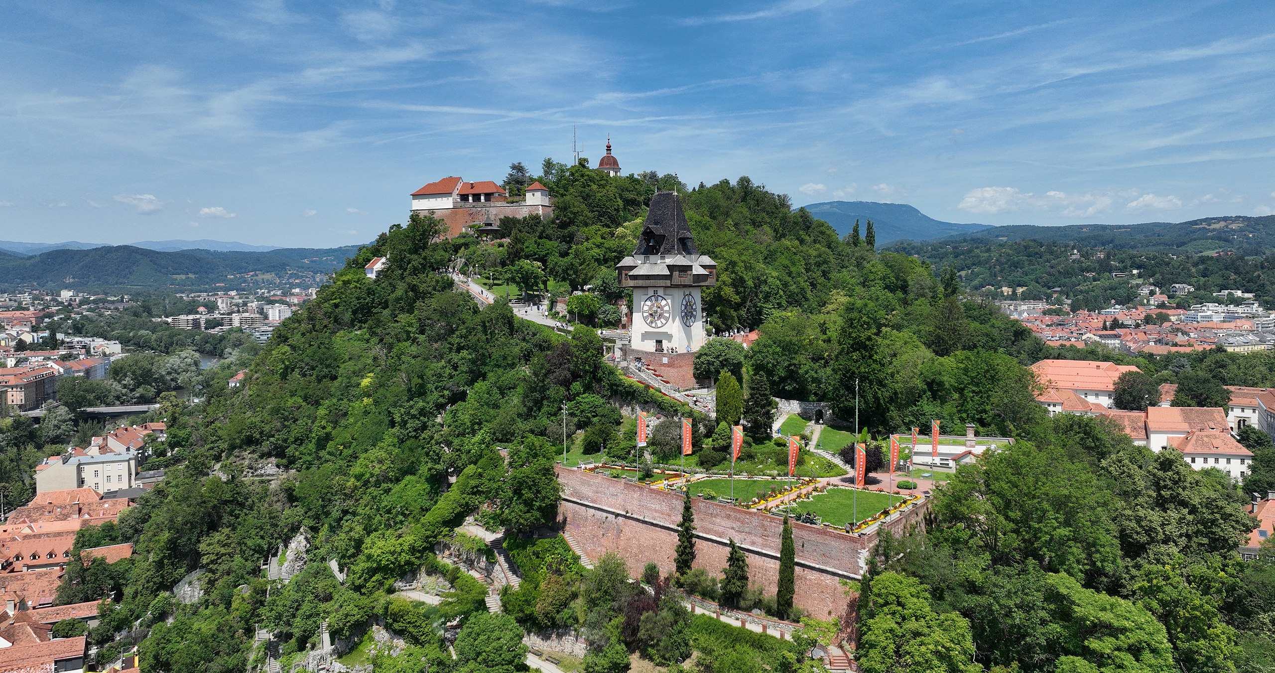
South view of the Schlossberg in Graz, Austria.
Summary[edit]
| Description |
Deutsch: Südansicht des Schloßberges in der steirischen Landeshauptstadt Graz und im Vordergrund die Bürgerbastei mit einer Beflaggung für die Styriarte sowie der Uhrturm.
Der Schloßberg in Graz bildet mit 123 Metern Höhe, ausgehend vom Grazer Hauptplatz, den höchsten natürlichen Punkt der Stadt. Ab dem 12. Jahrhundert wurde auf dem Berg eine Burg errichtet, die nie erobert wurde. Im Zuge der Napoleonischen Kriege wurde sie großteils gesprengt und abgetragen. Der befestigte mittelalterliche Uhrturm erhielt seine heutige Form um 1560 und ist das Wahrzeichen von Graz. Seine charakteristische Holzgalerie diente als Rundgang der Feuerwache: [1], [2]. English: South view of the Schlossberg in Graz, Austria. |
| Date | |
| Source | Own work |
| Author | C.Stadler/Bwag |
| Permission (Reusing this file) |
Deutsch: Hallo, du darfst mein Foto kostenlos nutzen, aber nenne mich bitte als Fotograf, beispielsweise „Foto: C.Stadler/Bwag“ oder © C.Stadler/Bwag; CC-BY-SA-4.0. Auf mehr Angaben bestehe ich nicht - im Gegensatz zu manch anderen, die die Vorgaben der unten angeführten Lizenzierung auf Punkt und Beistrich einfordern. English: Feel free to use my photos, but please mention me as the author like © C.Stadler/Bwag or © C.Stadler/Bwag; CC-BY-SA-4.0 (that's good enough) and if you want send me a message: bwag@gmx.net. |
| Other versions |
|
.JPG)
.JPG)
.JPG)
.JPG)
.JPG&action=edit§ion=1)
| Object location | | View this and other nearby images on: OpenStreetMap |
|---|
.JPG¶ms=047.073560_N_0015.437710_E_globe:Earth_class:object_type:object__&language=en)
| Camera location | | View this and other nearby images on: OpenStreetMap |
|---|
.JPG¶ms=047.072250_N_0015.437830_E_globe:Earth_type:camera_heading:355.00&language=en)
Licensing[edit]
.JPG&action=edit§ion=2)
I, the copyright holder of this work, hereby publish it under the following license:
This file is licensed under the Creative Commons Attribution-Share Alike 4.0 International license.
- You are free:
- to share – to copy, distribute and transmit the work
- to remix – to adapt the work
- Under the following conditions:
- attribution – You must give appropriate credit, provide a link to the license, and indicate if changes were made. You may do so in any reasonable manner, but not in any way that suggests the licensor endorses you or your use.
- share alike – If you remix, transform, or build upon the material, you must distribute your contributions under the same or compatible license as the original.
| Annotations | This image is annotated: View the annotations at Commons |
.JPG)
File history
Click on a date/time to view the file as it appeared at that time.
| Date/Time | Thumbnail | Dimensions | User | Comment | |
|---|---|---|---|---|---|
| current | 21:12, 20 June 2022 | | 5,000 × 2,639 (8.99 MB) | Bwag (talk | contribs) | == {{int:filedesc}} == {{Information |Description= {{de|1= Südansicht des Schloßberges in der steirischen Landeshauptstadt Graz und im Vordergrund die Bürgerbastei mit einer Beflaggung für die Styriarte sowie der Uhrturm.<br/>Der Schloßberg in Graz bildet mit 123 Metern Höhe, ausgehend vom Grazer Hauptplatz, den höchsten natürlichen Punkt der Stadt. Ab dem 12. Jahrhundert wurde auf dem Berg eine Burg errichtet, die nie erobert wurde. Im Zuge der Napoleonischen Kriege wurde... |
You cannot overwrite this file.
File usage on Commons
The following 2 pages use this file:
File usage on other wikis
The following other wikis use this file:
- Usage on de.wikipedia.org
- Usage on es.wikipedia.org
- Usage on ru.wikipedia.org
.JPG&oldid=706335925)