File:Tirol 1918.svg
Jump to navigation
Jump to search

Size of this PNG preview of this SVG file: 796 × 600 pixels. Other resolutions: 319 × 240 pixels | 637 × 480 pixels | 1,019 × 768 pixels | 1,280 × 965 pixels | 2,560 × 1,929 pixels | 1,502 × 1,132 pixels.
Original file (SVG file, nominally 1,502 × 1,132 pixels, file size: 94 KB)
Captions
Captions
Add a one-line explanation of what this file represents
Summary[edit]
| Description |
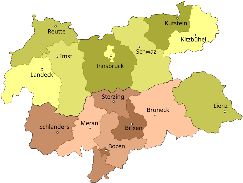
Map of North, South and Eastern Tirol with district borders Deutsch: Isolierte Lage des Bezirks Lienz (Osttirol) nach der Abtrennung Südtirols (rot) 1918
English: Tyrol after 1918, the southern part (light red) is now a part of Italy
Español: Mapa de Tirol con la división de 1918 que dejó el sur para Italia y el norte para Austria |
| Date | |
| Source | based on the map Image:Tirol 1918.png drawn by (Geiserich77) |
| Author | JesperZedlitz |
| Permission (Reusing this file) |
GNU FDL |
| Other versions |
|


Licensing[edit]

|
Permission is granted to copy, distribute and/or modify this document under the terms of the GNU Free Documentation License, Version 1.2 or any later version published by the Free Software Foundation; with no Invariant Sections, no Front-Cover Texts, and no Back-Cover Texts. A copy of the license is included in the section entitled GNU Free Documentation License. |
| This file is licensed under the Creative Commons Attribution-Share Alike 3.0 Unported license. | ||
| ||
| This licensing tag was added to this file as part of the GFDL licensing update. |
File history
Click on a date/time to view the file as it appeared at that time.
| Date/Time | Thumbnail | Dimensions | User | Comment | |
|---|---|---|---|---|---|
| current | 08:31, 7 September 2007 | | 1,502 × 1,132 (94 KB) | JesperZedlitz (talk | contribs) | Removed Italian text (confuses MediaWiki's SVG renderer). Will be put in a seperate image. |
| 08:26, 7 September 2007 |  | 1,502 × 1,132 (107 KB) | JesperZedlitz (talk | contribs) | == Beschreibung == {{Information| |Description = Map of North, South and Eastern Tirol with district borders {{de|Isolierte Lage des Bezirks Lienz (Osttirol) nach der Abtrennung Südtirols (rot) 1918}} {{en|Tyrol after 1918, the southern part (light red) |
You cannot overwrite this file.
File usage on Commons
The following 2 pages use this file:
File usage on other wikis
The following other wikis use this file:
- Usage on de.wikipedia.org
- Usage on fr.wikipedia.org