Oberrabnitz
Oberrabnitz is a village in Draßmarkt, Oberpullendorf District, Burgenland and has about 259 residents. Oberrabnitz is situated nearby to the villages Karl and Weingraben.Notable Places in the Area
Pfarrkirche St. Magdalena, Weingraben
Church

Photo: Ufoao, CC BY-SA 3.0 at.
Pfarrkirche St. Magdalena, Weingraben is a church situated 2½ km north of Oberrabnitz.
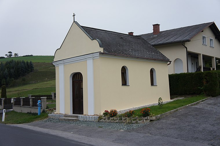
Mariä Himmelfahrt
Church

Photo: Ueb-at, CC BY-SA 3.0.
Mariä Himmelfahrt is a church situated 2½ km south of Oberrabnitz.
Localities in the Area
Kogl im Burgenland
Village

Photo: Nxr-at, CC BY-SA 4.0.
Kogl im Burgenland is a village situated 7 km southwest of Oberrabnitz.
Redlschlag
Village

Photo: Steindy, CC BY-SA 2.0 de.
Redlschlag is a village situated 8 km southwest of Oberrabnitz.
Hochstraß
Village

Photo: Bwag, CC BY-SA 4.0.
Hochstraß is a village situated 8 km southeast of Oberrabnitz.
Oberrabnitz
- Type: Village with 259 residents
- Description: locality and cadastral municipality in Oberpullendorf District
- Categories: cadastral municipality of Austria and locality
- Location: Draßmarkt, Oberpullendorf District, Burgenland, Austria, Central Europe, Europe
- View on OpenStreetMap
Latitude
47.49315° or 47° 29' 35" northLongitude
16.35438° or 16° 21' 16" eastPopulation
259Elevation
358 metres (1,175 feet)Open Location Code
8FVRF9V3+7QOpenStreetMap ID
node 240028344OpenStreetMap Feature
place=villageGeoNames ID
2769808Wikidata ID
Q877331Oberrabnitz Satellite Map
© OpenStreetMap, Mapbox and Maxar
Also Known As
- Bavarian: Oberrabnitz
- Croatian: Gornji Ramac
- Dutch: Oberrabnitz
- Esperanto: Oberrabnitz
- German: Oberrabnitz
- Hungarian: Felsőrámóc
- Irish: Oberrabnitz
- Japanese: オーバーラーブニッツ
- Spanish: Oberrabnitz
- Zgornji Ramac
Localities in the Area
- KarlVillage
- WeingrabenVillage, 2½ km north
- SchwendgrabenVillage, 2½ km south
- Steinbach im BurgenlandVillage, 3½ km southwest
- LembachVillage, 4½ km northwest
Landmarks in the Area
- Filialkirche Christi HimmelfahrtChurch
- Fernblick KarlScenic viewpoint
- Friedhof KarlCemetery
- Filialkirche hl. KatharinaChurch
- Furtner-KapelleChurch
Popular Destinations in Burgenland
Discover Eisenstadt, Neusiedl am See, Rust and Güssing.
Escape to a Random Place
Discover other destinations in the world.
About Mapcarta. Thanks to Mapbox for providing amazing maps. Data © OpenStreetMap contributors and available under the Open Database License. Text is available under the CC BY-SA 4.0 license, excluding photos, directions and the map. Photo: Cerana, CC BY-SA 3.0.