Landskron
Landskron is a suburb in Villach, Carinthia and has about 3,890 residents. Landskron is situated close to the neighborhoods Urlaken and Gratschach.Photo: Bwag, CC BY-SA 4.0.
Notable Places in the Area
Pfarrkirche Herz Mariae, Landskron
Church

Photo: Johann Jaritz, CC BY-SA 4.0.
Pfarrkirche Herz Mariae, Landskron is a church.
Landskron Castle

Photo: Bwag, CC BY-SA 4.0.
Landskron Castle is a medieval hill castle northeast of Villach in the state of Carinthia, Austria.
Filialkirche hll. Philipp und Jakob, Gratschach, Villach
Church

Photo: Johann Jaritz, CC BY-SA 3.0 at.
Filialkirche hll. Philipp und Jakob, Gratschach, Villach is a church.
Localities in the Area
Wernberg
Village

Photo: Johann Jaritz, CC BY-SA 3.0.
Wernberg is a municipality in the district of Villach-Land in the Austrian state of Carinthia. Wernberg is situated 3½ km east of Landskron.
Maria Gail
Suburb
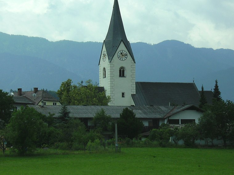
Photo: Wikimedia, CC BY-SA 3.0.
Maria Gail is a suburb situated 4 km south of Landskron.
Treffen
Village

Photo: Johann Jaritz, CC BY-SA 4.0.
Treffen is a market town in the district of Villach-Land in Carinthia in south-central Austria. Treffen is situated 4½ km northwest of Landskron.
Landskron
- Type: Suburb with 3,890 residents
- Categories: neighborhood, former municipality of Austria and locality
- Location: Villach, Carinthia, Austria, Central Europe, Europe
- View on OpenStreetMap
Latitude
46.63364° or 46° 38' 1" northLongitude
13.88727° or 13° 53' 14" eastPopulation
3,890Elevation
497 metres (1,631 feet)Open Location Code
8FRMJVMP+FWOpenStreetMap ID
node 240106879OpenStreetMap Feature
place=suburbGeoNames ID
2773045Wikidata ID
Q1803871Landskron Satellite Map
© OpenStreetMap, Mapbox and Maxar
Also Known As
- Dutch: Landskron
- German: Landskron
- Slovenian: Vajškra
- Turkish: Landskron
Other Places Named Landskron
Localities in the Area
- UrlakenNeighborhood
- GratschachNeighborhood
- KumitzNeighborhood
- St. MichaelNeighborhood
- NeulandskronQuarter
Landmarks in the Area
- Stadtpark LandskronPark
- Evangelikale Gemeinde VillachChurch
- PfarrsaalChurch
- PfarrhofChurch
- SeebachRiver
Popular Destinations in Carinthia
Discover Klagenfurt, Wörthersee, Spittal an der Drau and Friesach.
Escape to a Random Place
Discover other destinations in the world.
About Mapcarta. Thanks to Mapbox for providing amazing maps. Data © OpenStreetMap contributors and available under the Open Database License. Text is available under the CC BY-SA 4.0 license, excluding photos, directions and the map. Photo: Bwag, CC BY-SA 4.0.