Kogl im Burgenland
Kogl im Burgenland is a village in Pilgersdorf, Oberpullendorf District, Burgenland and has about 105 residents. Kogl im Burgenland is situated nearby to the villages Redlschlag and Lebenbrunn.Photo: Nxr-at, CC BY-SA 4.0.
Notable Places in the Area

Sebastianssäule Lebenbrunn
Memorial

Photo: Robert Heilinger, CC BY-SA 3.0.
Sebastianssäule Lebenbrunn is a memorial.
Filialkirche hl. Antonius
Church

Photo: Robert Heilinger, CC BY-SA 3.0.
Filialkirche hl. Antonius is a church situated 3½ km north of Kogl im Burgenland.
Localities in the Area

Stuben
Village
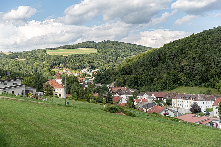
Photo: Tsui, CC BY-SA 4.0.
Stuben is a village situated 4 km southwest of Kogl im Burgenland.
Salmannsdorf
Village
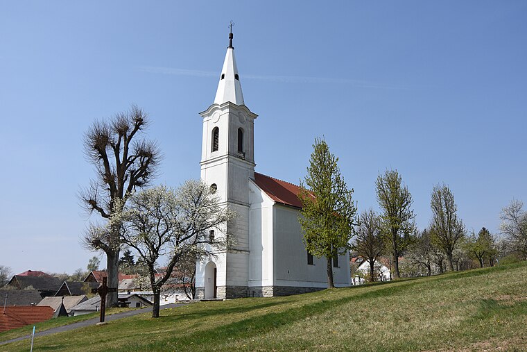
Photo: Nxr-at, CC BY-SA 4.0.
Salmannsdorf is a village situated 4 km southeast of Kogl im Burgenland.
Kogl im Burgenland
- Type: Village with 105 residents
- Description: locality and cadastral municipality in Oberpullendorf District
- Categories: cadastral municipality of Austria and locality
- Location: Pilgersdorf, Oberpullendorf District, Burgenland, Austria, Central Europe, Europe
- View on OpenStreetMap
Latitude
47.44523° or 47° 26' 43" northLongitude
16.29876° or 16° 17' 56" eastPopulation
105Elevation
609 metres (1,998 feet)Open Location Code
8FVRC7WX+3GOpenStreetMap ID
node 240032277OpenStreetMap Feature
place=villageGeoNames ID
2773827Wikidata ID
Q592005Kogl im Burgenland Satellite Map
© OpenStreetMap, Mapbox and Maxar
Also Known As
- Croatian: Koglin
- English: Kogl
- Esperanto: Kogl im Burgenland
- German: Kogl
- German: Kogl im Burgenland
- Hungarian: Kúpfalva
- Irish: Kogl im Burgenland
Localities in the Area
- LebenbrunnVillage
- KalteneckHamlet, 2½ km west
- SteinmühleHamlet, 2½ km northwest
- HabichHamlet, 3 km northwest
- UngerbachHamlet, 3½ km northwest
Landmarks in the Area
- FF KoglFire station
- KoglbergPeak
- Evang. FilialkircheChurch
- Kath. PfarrzentrumChurch
- Friedhof RedlschlagCemetery
Popular Destinations in Burgenland
Discover Eisenstadt, Neusiedl am See, Rust and Güssing.
Escape to a Random Place
Discover other destinations in the world.
About Mapcarta. Thanks to Mapbox for providing amazing maps. Data © OpenStreetMap contributors and available under the Open Database License. Text is available under the CC BY-SA 4.0 license, excluding photos, directions and the map. Photo: Nxr-at, CC BY-SA 4.0.