Hasendorf im Burgenland
Hasendorf im Burgenland is a hamlet in Tobaj, Güssing District, Burgenland and has about 96 residents. Hasendorf im Burgenland is situated close to the hamlets Sauerberg and Fabianische Häuser.Notable Places in the Area
Güssing Castle
Museum

Photo: Bwag, CC BY-SA 3.0 at.
Güssing Castle is a castle in southern Burgenland, Austria. Güssing Castle is situated 3 km southeast of Hasendorf im Burgenland.

Klosterkirche – Franziskanerkloster – Familiengruft der Batthyány
Church
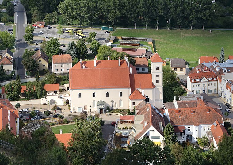
Photo: Bwag, CC BY-SA 3.0 at.
Klosterkirche – Franziskanerkloster – Familiengruft der Batthyány is a church situated 3 km southeast of Hasendorf im Burgenland.
Localities in the Area

Güssing

Photo: Ueb-at, CC BY-SA 3.0.
Güssing is a town in Burgenland, Austria. It is located at 47°4′N 16°19′E / 47.067°N 16.317°E, with a population of 3,610, and is the administrative center of the Güssing district.
Gerersdorf bei Güssing
Village

Photo: Bwag, CC BY-SA 4.0.
Gerersdorf bei Güssing is a village situated 3½ km west of Hasendorf im Burgenland.
Hasendorf im Burgenland
- Type: Hamlet with 96 residents
- Description: locality and cadastral community in Güssing District
- Categories: cadastral municipality of Austria and locality
- Location: Tobaj, Güssing District, Burgenland, Austria, Central Europe, Europe
- View on OpenStreetMap
Latitude
47.07745° or 47° 4' 39" northLongitude
16.29773° or 16° 17' 52" eastPopulation
96Elevation
233 metres (764 feet)Open Location Code
8FVR37GX+X3OpenStreetMap ID
node 240119864OpenStreetMap Feature
place=hamletGeoNames ID
2776733Wikidata ID
Q1402219Hasendorf im Burgenland Satellite Map
© OpenStreetMap, Mapbox and Maxar
Also Known As
- Esperanto: Hasendorf im Burgenland
- German: Hasendorf im Burgenland
- Hungarian: Vasnyúlfalu
- Irish: Hasendorf im Burgenland
- Hasendorf
Localities in the Area
- SauerbergHamlet
- Fabianische HäuserHamlet
- TobajVillage
- KrottendorfVillage
- Sulz im BurgenlandVillage
Landmarks in the Area
- Tobajer KogelPeak
- Hof Wunderkind
- Biomasse-Kraftwerk GüssingPower station
- Wirtschaftskammer Burgenland Regionalstelle GüssingGovernment office
- Technologiezentrum GüssingGovernment office
Popular Destinations in Burgenland
Discover Eisenstadt, Neusiedl am See, Rust and Güssing.
Escape to a Random Place
Discover other destinations in the world.
About Mapcarta. Thanks to Mapbox for providing amazing maps. Data © OpenStreetMap contributors and available under the Open Database License. Text is available under the CC BY-SA 4.0 license, excluding photos, directions and the map. Photo: Cerana, CC BY-SA 3.0.