Pertitschach
Pertitschach is a village in Keutschach am See, Klagenfurt-Land District, Carinthia and has about 189 residents. Pertitschach is situated nearby to the village Höflein and the hamlet Leisbach.Notable Places in the Area
Rauschelesee
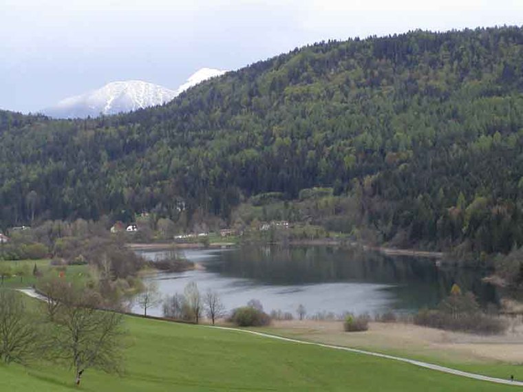
Photo: Rauschelesee, CC BY 2.5.
Rauschelesee is a lake in Keutschacher Seental near Lake Keutschach in the town Keutschach, Carinthia, Austria.
Composing hut of Gustav Mahler

Photo: Johann Jaritz, CC BY-SA 4.0.
The composing hut of Gustav Mahler is a small museum and memorial in Maiernigg, near Maria Wörth in Carinthia, Austria.

Localities in the Area
Maria Rain
Village
Maria Rain is a town in the district of Klagenfurt-Land in the Austrian state of Carinthia, known for its Baroque parish and pilgrimage church. Maria Rain is situated 6 km southeast of Pertitschach.
Klagenfurt
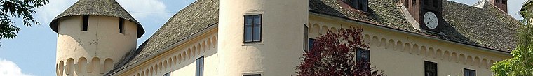
Photo: Johann Jaritz, CC BY-SA 4.0.
Klagenfurt is the capital of Carinthia in Austria. It was one of the eight host cities in the 2008 European Football Championships.
Pörtschach

Photo: Johann Jaritz, CC BY-SA 3.0 at.
Pörtschach am Wörthersee is a municipality in the district of Klagenfurt-Land in Carinthia, Austria.
Pertitschach
- Type: Village with 189 residents
- Category: locality
- Location: Keutschach am See, Klagenfurt-Land District, Carinthia, Austria, Central Europe, Europe
- View on OpenStreetMap
Latitude
46.59067° or 46° 35' 26" northLongitude
14.22303° or 14° 13' 23" eastPopulation
189Elevation
545 metres (1,788 feet)Open Location Code
8FRPH6RF+76OpenStreetMap ID
node 583230961OpenStreetMap Feature
place=villageGeoNames ID
3219220Pertitschach Satellite Map
© OpenStreetMap, Mapbox and Maxar
Localities in the Area
- HöfleinVillage
- LeisbachHamlet
- Sankt NikolaiVillage
- ReauzVillage
- MigoriachHamlet
Landmarks in the Area
- Strandbad RauscheleseePark
- Filialkirche St. NikolaiChurch
- ZauberwaldPlayground
- Oberer SpintikteichPond
- Pferdehof Tiffany
Popular Destinations in Carinthia
Discover Klagenfurt, Villach, Wörthersee and Spittal an der Drau.
Escape to a Random Place
Discover other destinations in the world.
About Mapcarta. Thanks to Mapbox for providing amazing maps. Data © OpenStreetMap contributors and available under the Open Database License. Text is available under the CC BY-SA 4.0 license, excluding photos, directions and the map. Photo: Wikimedia, CC BY-SA 3.0.