Podlanig
Podlanig is a village in Kötschach-Mauthen, Hermagor District, Carinthia and has about 51 residents and an elevation of 966 metres. Podlanig is situated nearby to the hamlets Würda and Aigen.Notable Places in the Area
Filialkirche Ulrich und Martin, Lesachtal
Church

Photo: Thomas Ledl, CC BY-SA 4.0.
Filialkirche Ulrich und Martin, Lesachtal is a church.

Localities in the Area
Mussen
Locality
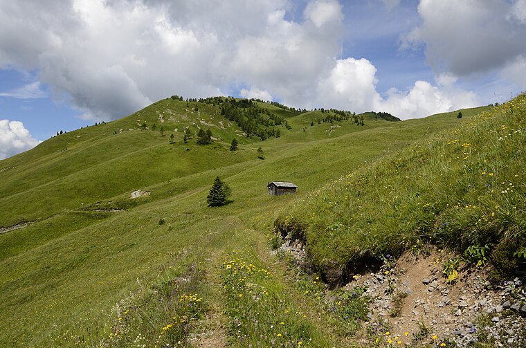
Photo: Johann Jaritz, CC BY-SA 3.0 at.
Mussen is a locality situated 3 km northeast of Podlanig.
Gentschach
Hamlet

Photo: Niki.L, CC BY-SA 4.0.
Gentschach is a hamlet situated 4 km east of Podlanig.
Mauthen
Village

Photo: Johann Jaritz, CC BY-SA 3.0 at.
Mauthen is a village situated 7 km east of Podlanig.
Podlanig
- Type: Village with 51 residents
- Category: locality
- Location: Kötschach-Mauthen, Hermagor District, Carinthia, Austria, Central Europe, Europe
- View on OpenStreetMap
Latitude
46.68672° or 46° 41' 12" northLongitude
12.9105° or 12° 54' 38" eastPopulation
51Elevation
966 metres (3,169 feet)Open Location Code
8FRJMWP6+M6OpenStreetMap ID
node 240045132OpenStreetMap Feature
place=villageGeoNames ID
11594183Podlanig Satellite Map
© OpenStreetMap, Mapbox and Maxar
Other Places Named Podlanig
Localities in the Area
- WürdaHamlet
- AigenHamlet
- Sankt Jakob im LesachtalVillage
- KornatHamlet
- FinstergrabenLocality
Landmarks in the Area
- MegaDiveScenic viewpoint
- Hl. JakobChurch
- Kirche BirnbaumChurch
- Pfarrkirche KornatCemetery
- MussenPeak, 3 km northeast
Popular Destinations in Carinthia
Discover Klagenfurt, Villach, Wörthersee and Spittal an der Drau.
Escape to a Random Place
Discover other destinations in the world.
About Mapcarta. Thanks to Mapbox for providing amazing maps. Data © OpenStreetMap contributors and available under the Open Database License. Text is available under the CC BY-SA 4.0 license, excluding photos, directions and the map. Photo: Wikimedia, CC BY-SA 3.0.