Schulterndorf
Schulterndorf is a village in Grafenstein, Klagenfurt-Land District, Carinthia and has about 165 residents. Schulterndorf is situated close to the hamlet Truttendorf and the village Pirk.Notable Places in the Area
Grafenstein
Town hall
Grafenstein is a town in the district of Klagenfurt-Land in the Austrian state of Carinthia.
Aufnahmsgebäude Bahnhof Grafenstein
Railway station
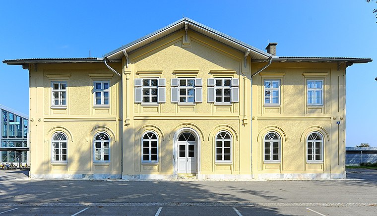
Photo: Johann Jaritz, CC BY-SA 3.0.
Aufnahmsgebäude Bahnhof Grafenstein is a railway station.
Pfarrhof Grafenstein
Public building

Photo: Johann Jaritz, CC BY-SA 3.0 at.
Pfarrhof Grafenstein is a public building.
Localities in the Area
Lipizach
Hamlet

Photo: Streunerich, CC BY-SA 4.0.
Lipizach is a hamlet situated 6 km southwest of Schulterndorf.
Kossiach
Hamlet

Photo: Johann Jaritz, CC BY-SA 3.0.
Kossiach is a hamlet situated 7 km southwest of Schulterndorf.
Schulterndorf
- Type: Village with 165 residents
- Category: locality
- Location: Grafenstein, Klagenfurt-Land District, Carinthia, Austria, Central Europe, Europe
- View on OpenStreetMap
Latitude
46.61555° or 46° 36' 56" northLongitude
14.44855° or 14° 26' 55" eastPopulation
165Elevation
417 metres (1,368 feet)Open Location Code
8FRPJC8X+6COpenStreetMap ID
node 240117545OpenStreetMap Feature
place=villageGeoNames ID
11608996Schulterndorf Satellite Map
© OpenStreetMap, Mapbox and Maxar
Localities in the Area
- TruttendorfHamlet
- PirkVillage
- UnterwuchelHamlet
- AichHamlet
- GrafensteinVillage
Landmarks in the Area
- Bahnhof GrafensteinRailway station
- RinnwaldForest
- Veranstaltungszentrum HambruschsaalPublic building
- ÖR-Valentin-Deutschmann-PlatzSquare
- Polizeiinspektion GrafensteinPolice station
Popular Destinations in Carinthia
Discover Klagenfurt, Villach, Wörthersee and Spittal an der Drau.
Escape to a Random Place
Discover other destinations in the world.
About Mapcarta. Thanks to Mapbox for providing amazing maps. Data © OpenStreetMap contributors and available under the Open Database License. Text is available under the CC BY-SA 4.0 license, excluding photos, directions and the map. Photo: Wikimedia, CC BY-SA 3.0.