Langeck im Burgenland
Langeck im Burgenland is a village in Lockenhaus, Oberpullendorf District, Burgenland and has about 204 residents. Langeck im Burgenland is situated close to the hamlet Miniau and the village Deutsch Gerisdorf.Notable Places in the Area

Burg Lockenhaus

Photo: Bwag, CC BY-SA 4.0.
Burg Lockenhaus is a castle and medieval fortress in the Güns Valley in the southeastern part of Lockenhaus, in Burgenland, eastern Austria. Burg Lockenhaus is situated 3½ km east of Langeck im Burgenland.
Filialkirche Deutsch Gerisdorf
Church
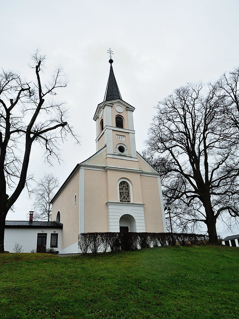
Photo: Robert Heilinger, CC BY-SA 3.0.
Filialkirche Deutsch Gerisdorf is a church.
Localities in the Area
Hochstraß
Village

Photo: Bwag, CC BY-SA 4.0.
Hochstraß is a village situated 3½ km northeast of Langeck im Burgenland.
Günseck
Village
Photo: Wikimedia, Public domain.
Günseck is a village situated 4 km west of Langeck im Burgenland.
Salmannsdorf
Village
Photo: Nxr-at, CC BY-SA 4.0.
Salmannsdorf is a village situated 4 km west of Langeck im Burgenland.
Langeck im Burgenland
- Type: Village with 204 residents
- Description: locality and cadastral municipality in Oberpullendorf District
- Categories: cadastral municipality of Austria and locality
- Location: Lockenhaus, Oberpullendorf District, Burgenland, Austria, Central Europe, Europe
- View on OpenStreetMap
Latitude
47.40199° or 47° 24' 7" northLongitude
16.37501° or 16° 22' 30" eastPopulation
204Elevation
347 metres (1,138 feet)Open Location Code
8FVRC92G+Q2OpenStreetMap ID
node 240095916OpenStreetMap Feature
place=villageWikidata ID
Q339653Langeck im Burgenland Satellite Map
© OpenStreetMap, Mapbox and Maxar
Also Known As
- Bavarian: Langeck
- Bavarian: Langeck im Burgenland
- English: Langeck
- Esperanto: Langeck im Burgenland
- French: Langeck
- French: Langeck im Burgenland
- German: Langeck
- German: Langeck im Burgenland
- Hungarian: Hosszúszeg
- Irish: Langeck im Burgenland
Other Places Named Langeck im Burgenland
Localities in the Area
- MiniauHamlet
- Deutsch GerisdorfVillage
- WeißenbachlHamlet, 2½ km southwest
- Glashütten bei Langeck im BurgenlandVillage, 3 km south
- FöhrenhöheHamlet, 3 km northeast
Landmarks in the Area
- Sportplatz Deutsch GerisdorfPitch
- FF Deutsch GerisdorfFire station
- Spielplatz Deutsch GerisdorfPlayground
- MMFC LockenhausGrassland
- StieglteichPond
Popular Destinations in Burgenland
Discover Eisenstadt, Neusiedl am See, Rust and Güssing.
Escape to a Random Place
Discover other villages in the world.
About Mapcarta. Thanks to Mapbox for providing amazing maps. Data © OpenStreetMap contributors and available under the Open Database License. Text is available under the CC BY-SA 4.0 license, excluding photos, directions and the map. Photo: Cerana, CC BY-SA 3.0.