Kapelle Neuberg/Bergen
Kapelle Neuberg/Bergen is a church in Mischendorf, Oberwart District, Burgenland. Kapelle Neuberg/Bergen is situated close to the pitch Tennis and the peak Steinriegel.Notable Places in the Area
Filialkirche Christi Himmelfahrt, Rohrbach an der Teich
Church

Photo: Funke, CC BY-SA 4.0.
Filialkirche Christi Himmelfahrt, Rohrbach an der Teich is a church situated 2½ km northeast of Kapelle Neuberg/Bergen.
Pfarrkirche Mischendorf
Church
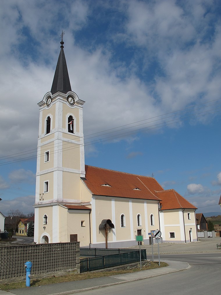
Photo: Ueb-at, CC BY-SA 3.0.
Pfarrkirche Mischendorf is a church situated 3 km east of Kapelle Neuberg/Bergen.
Kirche Neuhaus in der Wart
Church
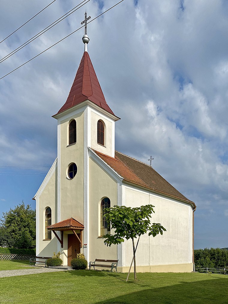
Photo: Funke, CC BY-SA 4.0.
Kirche Neuhaus in der Wart is a church situated 3 km north of Kapelle Neuberg/Bergen.
Localities in the Area
Rohrbach an der Teich
Village

Photo: Funke, CC BY-SA 4.0.
Rohrbach an der Teich is a village situated 2½ km northeast of Kapelle Neuberg/Bergen.
Großbachselten
Village

Photo: Funke, CC BY-SA 4.0.
Großbachselten is a village situated 3 km northeast of Kapelle Neuberg/Bergen.
Kleinbachselten
Village

Photo: Funke, CC BY-SA 4.0.
Kleinbachselten is a village situated 3 km northeast of Kapelle Neuberg/Bergen.
Kapelle Neuberg/Bergen
- Type: Church
- Denomination: Catholic
- Categories: place of worship and religion
- Location: Mischendorf, Oberwart District, Burgenland, Austria, Central Europe, Europe
- View on OpenStreetMap
Latitude
47.18969° or 47° 11' 23" northLongitude
16.27263° or 16° 16' 22" eastOpen Location Code
8FVR57QF+V3OpenStreetMap ID
node 322654572OpenStreetMap Feature
amenity=place_of_worshipOpenStreetMap Attribute
denomination=catholicKapelle Neuberg/Bergen Satellite Map
© OpenStreetMap, Mapbox and Maxar
Landmarks in the Area
- TennisPitch, 210 metres north
- SteinriegelPeak
- UngarbergPeak
- SaubergPeak
- Hubertus-KapelleChurch, 2 km west
Places in the Area
- Gasthaus DergovitsRestaurant
- Franz WerderitsWayside cross, 1½ km north
- Rohrbach an der Teich OrtsmitteBus stop, 2½ km northeast
Popular Destinations in Burgenland
Discover Eisenstadt, Neusiedl am See, Rust and Güssing.
Escape to a Random Place
Discover other churches in the world.
About Mapcarta. Thanks to Mapbox for providing amazing maps. Data © OpenStreetMap contributors and available under the Open Database License. Text is available under the CC BY-SA 4.0 license, excluding photos, directions and the map. Photo: Cerana, CC BY-SA 3.0.