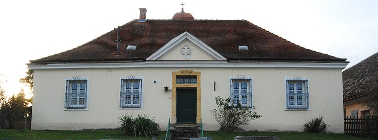
Breitenwaida Kirche
Breitenwaida Kirche is a church in Hollabrunn, Lower Austria. Breitenwaida Kirche is situated nearby to the building Breitenwaida Pfarrhof and the fire station Freiwillige Feuerwehr Breitenwaida.Photo: Bwag, CC BY-SA 4.0.
- Type: Church
- Denomination: Roman Catholic
- Description: church building in Hollabrunn, Austria
Notable Places in the Area
Breitenwaida halt
Railway stop

Photo: Priwo, Public domain.
Breitenwaida halt is a railway stop situated 610 metres east of Breitenwaida Kirche.
Localities in the Area
Raschala
Village

Photo: Maclemo, CC BY-SA 4.0.
Raschala is a village situated 3½ km northeast of Breitenwaida Kirche.
Ringendorf
Village

Photo: Maclemo, CC BY-SA 4.0.
Ringendorf is a village situated 10 km east of Breitenwaida Kirche.
Füllersdorf
Village

Photo: Linie29, CC BY-SA 3.0.
Füllersdorf is a village situated 10 km east of Breitenwaida Kirche.
Breitenwaida Kirche
- Categories: building, place of worship and religion
- Location: Hollabrunn, Hollabrunn District, Lower Austria, Austria, Central Europe, Europe
- View on OpenStreetMap
Latitude
48.51464° or 48° 30' 53" northLongitude
16.06646° or 16° 3' 59" eastOpen Location Code
8FWRG378+VHOpenStreetMap ID
way 135793199OpenStreetMap Feature
amenity=place_of_worshipOpenStreetMap Feature
building=churchOpenStreetMap Attribute
denomination=roman_catholicWikidata ID
Q37889248Breitenwaida Kirche Satellite Map
© OpenStreetMap, Mapbox and Maxar
Also Known As
- German: Kath. Pfarrkirche Maria Heimsuchung
- German: Pfarrkirche Breitenwaida
- Pfarrkirche 'Maria Heimsuchung'
Landmarks in the Area
- Freiwillige Feuerwehr BreitenwaidaFire station, 150 metres northeast
- SV BreitenwaidaSports venue, 210 metres east
- KinderspielplatzPlayground, 220 metres east
- Kultur und GemeindehausArts center, 230 metres northeast
Places in the Area
- Pfarrhof BreitenwaidaBuilding
- Animal Rescue Academy
- ANIviVETVeterinarian
- KriegerdenkmalMemorial
- Kindergarten BreitenwaidaKindergarten, 210 metres northeast
Popular Destinations in Lower Austria
Discover St. Pölten, Wiener Neustadt, Amstetten and Klosterneuburg.
Escape to a Random Place
Discover other churches in the world.
About Mapcarta. Thanks to Mapbox for providing amazing maps. Data © OpenStreetMap contributors and available under the Open Database License. Text is available under the CC BY-SA 4.0 license, excluding photos, directions and the map. Photo: Bwag, CC BY-SA 4.0.