Straniger Alm
Straniger Alm is a mountain hut in Kirchbach, Hermagor District, Carinthia located on Straninger Alm and has an elevation of 1,501 metres. Straniger Alm is situated close to the saddle Passo di Melédis / Straniger Sattel and the peak Leitenkogel.- Email: kkanzian@edu.aau.at
- Type: Mountain hut
- Address: Straninger Alm 1, Stranigeralpe, Kirchbach, 9633
Notable Places in the Area
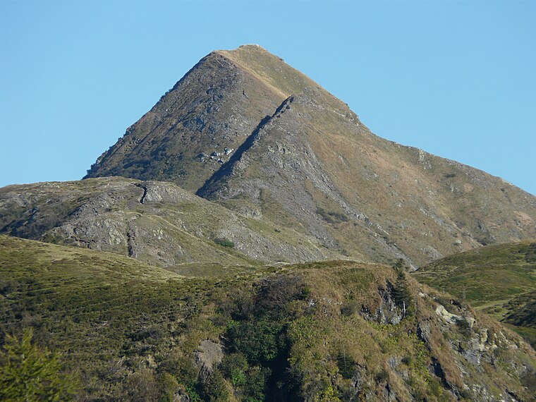
Schulterkofel
Peak
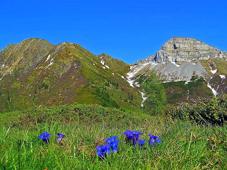
Photo: Vid Pogacnik, CC BY-SA 4.0.
Schulterkofel is a peak situated 3 km east of Straniger Alm.
Hochwipfel
Peak
Photo: Vid Pogacnik, CC BY-SA 4.0.
Hochwipfel is a peak situated 3 km east of Straniger Alm.
Localities in the Area
Grafendorf (Gemeinde Kirchbach)
Village

Photo: Wikimedia, CC BY-SA 3.0.
Grafendorf (Gemeinde Kirchbach) is a village situated 7 km north of Straniger Alm.
Paularo
Village

Photo: Wikimedia, CC BY-SA 3.0.
Paularo is a comune in the Regional decentralization entity of Udine in the Italian region of Friuli Venezia Giulia, located about 110 kilometres northwest of Trieste and about 50 kilometres north of Udine, on the border with Austria. Paularo is situated 7 km south of Straniger Alm.
Ligosullo
Village

Photo: Tiesse, Public domain.
Ligosullo is a frazione of Treppo Ligosullo in the Province of Udine in the Italian region Friuli Venezia Giulia, located about 110 kilometres northwest of Trieste and about 50 kilometres north of Udine. Ligosullo is situated 8 km southwest of Straniger Alm.
Straniger Alm
- Categories: mountain pasture, building, tourism and accommodation
- Location: Kirchbach, Hermagor District, Carinthia, Austria, Central Europe, Europe
- View on OpenStreetMap
Latitude
46.5956° or 46° 35' 44" northLongitude
13.13431° or 13° 8' 4" eastElevation
1,501 metres (4,925 feet)Operator
Klaus Kanzian 9634 Grafedndorf 81 +43(0)650/3726174Open Location Code
8FRMH4WM+6POpenStreetMap ID
way 136912400OpenStreetMap Feature
building=yesOpenStreetMap Feature
tourism=alpine_hutWikidata ID
Q2353553Straniger Alm Satellite Map
© OpenStreetMap, Mapbox and Maxar
Also Known As
- German: Straniger Alm
Landmarks in the Area
- Passo di Melédis / Straniger SattelSaddle
- LeitenkogelPeak
- BuhlePeak
- Straniger KopfPeak
- GugelPeak
Places in the Area
- KäsestubeFarm shop
- ZollhütteBuilding, 180 metres southeast
- Straniger OchsenalmBuilding, 1 km northwest
- Casera Meledis altaBuilding, 1¼ km south
- Casera Valbertad altaBuilding, 1½ km southeast
Popular Destinations in Carinthia
Discover Klagenfurt, Villach, Wörthersee and Spittal an der Drau.
Escape to a Random Place
Discover other mountain huts in the world.
About Mapcarta. Thanks to Mapbox for providing amazing maps. Data © OpenStreetMap contributors and available under the Open Database License. Text is available under the CC BY-SA 4.0 license, excluding photos, directions and the map. Photo: Mikmaq, CC BY 3.0.