Annakapelle, Unterloisdorf
Annakapelle, Unterloisdorf is a church in Mannersdorf an der Rabnitz, Oberpullendorf District, Burgenland. Annakapelle, Unterloisdorf is situated nearby to the cemetery Friedhof Unterloisdorf and the church Kath. Filialkirche hl. Radegundis, Unterloisdorf.Photo: Hadinger, CC BY-SA 3.0 at.
Notable Places in the Area
Kath. Filialkirche hl. Radegundis, Unterloisdorf
Church

Photo: Ufoao, CC BY-SA 3.0 at.
Kath. Filialkirche hl. Radegundis, Unterloisdorf is a church situated 670 metres southeast of Annakapelle, Unterloisdorf.
Schüttkasten Mannersdorf an der Rabnitz
Public building

Photo: Robert Heilinger, CC BY-SA 3.0.
Schüttkasten Mannersdorf an der Rabnitz is a public building situated 1 km south of Annakapelle, Unterloisdorf.
Pfarrkirche Hl. Dreifaltigkeit, Mannersdorf an der Rabnitz
Church

Photo: Hadinger, CC BY-SA 3.0 at.
Pfarrkirche Hl. Dreifaltigkeit, Mannersdorf an der Rabnitz is a church situated 1½ km south of Annakapelle, Unterloisdorf.
Localities in the Area
Liebing
Village
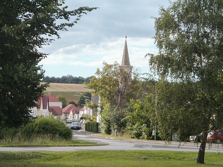
Photo: Wikimedia, Public domain.
Liebing is a village in the district of Oberpullendorf in Burgenland in Austria. Liebing is situated 4 km southwest of Annakapelle, Unterloisdorf.

Hammerteich
Village
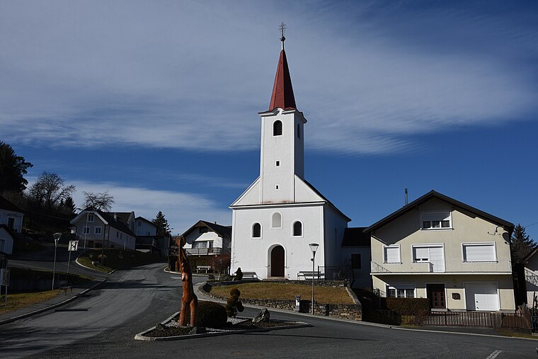
Photo: Iswoar, CC BY-SA 4.0.
Hammerteich is a village situated 8 km southwest of Annakapelle, Unterloisdorf.
Annakapelle, Unterloisdorf
- Type: Church
- Description: building in Mannersdorf an der Rabnitz, Austria
- Categories: chapel, building, place of worship and religion
- Location: Mannersdorf an der Rabnitz, Oberpullendorf District, Burgenland, Austria, Central Europe, Europe
- View on OpenStreetMap
Latitude
47.44229° or 47° 26' 32" northLongitude
16.52753° or 16° 31' 39" eastOpen Location Code
8FVRCGRH+W2OpenStreetMap ID
way 341375659OpenStreetMap Feature
amenity=place_of_worshipOpenStreetMap Feature
building=chapelWikidata ID
Q38128455Annakapelle, Unterloisdorf Satellite Map
© OpenStreetMap, Mapbox and Maxar
Also Known As
- German: Annakapelle
Landmarks in the Area
- Friedhof UnterloisdorfCemetery, 610 metres southeast
- Dorfzentrum, Schule, UnterloisdorfBuilding, 1 km southeast
- SportplatzPitch, 1½ km south
- evangelische KircheChurch, 1½ km northwest
- Rochuskapelle UnterloisdorfWayside shrine, 1½ km southeast
Places in the Area
- TabormühleBuilding, 500 metres south
- Unterloisdorf KircheBus stop, 660 metres southeast
- Gasthaus PröstlPub, 760 metres south
- Unterloisdorf OrtsmitteBus stop, 1 km southeast
Popular Destinations in Burgenland
Discover Eisenstadt, Neusiedl am See, Rust and Güssing.
Escape to a Random Place
Discover other churches in the world.
About Mapcarta. Thanks to Mapbox for providing amazing maps. Data © OpenStreetMap contributors and available under the Open Database License. Text is available under the CC BY-SA 4.0 license, excluding photos, directions and the map. Photo: Hadinger, CC BY-SA 3.0 at.