Tour data
8.09km
633
- 779m
225hm
226hm
02:05h
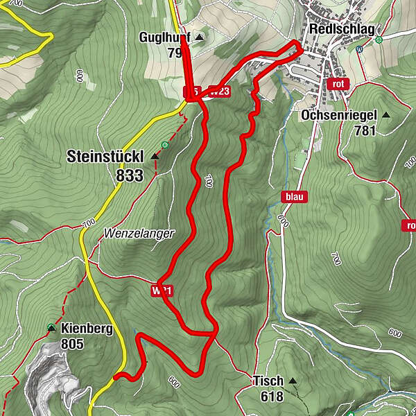
- Difficulty
-
medium
- Route
-
Guglhupf (794 m)0.0 kmRedlschlag (691 m)1.2 kmGuglhupf (794 m)8.0 km
- Highest point
- 779 m
- Source
- Bergfex Tour Generator
GPS Downloads


Other tours in the regions
-
Wiener Alpen
3064
-
Bucklige Welt - Wiener Alpen
792
-
Bernstein
182