
- Brief description
-
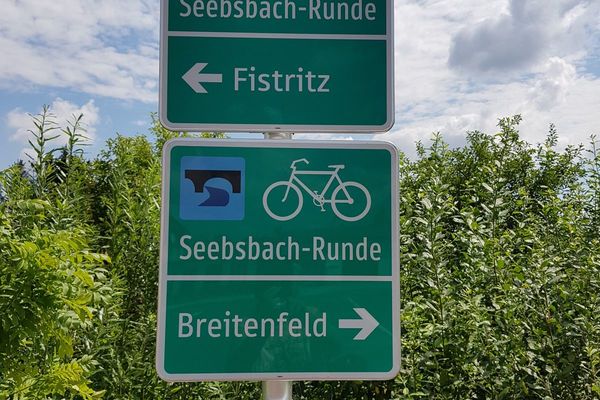
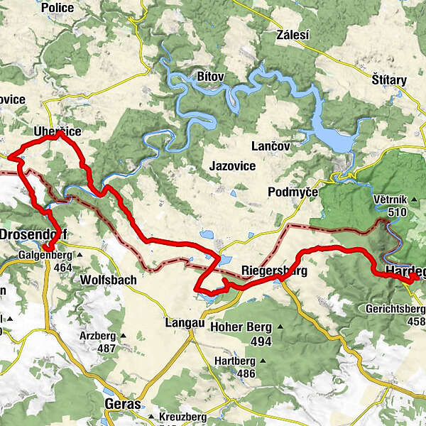
Drosendorf-Unterthürnau-Oberthürnau-Vrantenin-Uhercice-Stalky-Safov-Riegersburg-Felling-Hardegg
- Route
-
DrosendorfDrosendorf Altstadt0.8 kmZur Hammerschmiede0.9 kmUnterthürnau2.7 kmhl. Magdalena2.8 kmOberthürnau4.1 kmFratting6.3 kmUngarschitz8.6 kmNa Kolářce9.3 kmStallek16.5 kmHospoda Na Konci Světa16.6 kmNanebevzetí Panny Marie16.7 kmRiegersburg26.9 kmFelling30.3 kmSt. Peter und Paul30.4 kmGasthof Hammerschmiede35.5 kmVorstadt35.7 kmHardegg36.2 kmGasthaus Thayabrücke36.6 km
- Description
-
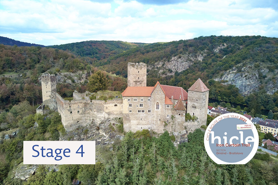
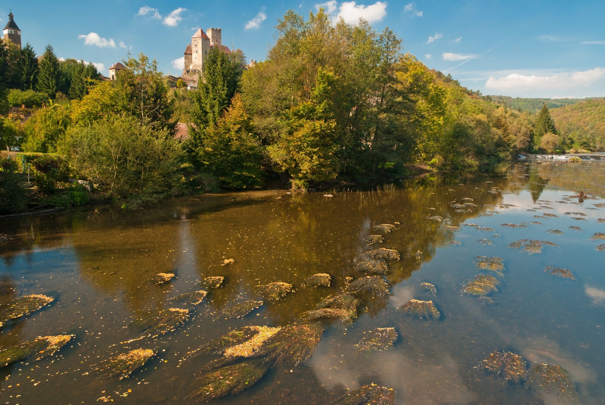
From Drosendorf head up to the picturesque village of Vratěnín, which lies already within the region of South Moravia. You can visit the castle in Uherčice or you can cool down in the natural swimming pool in Langau in Lower Austria (which also offers visitors a rural museum). There is an interesting museum for pearl oysters in Felling. You will leave the Waldviertel region after the village and enter the Weinviertel wine region. Before entering the Czech Republic you will visit the smallest Austrian town of Hardegg with a beautiful silhouette of the castle above the Thaya River.
Coming from the west, the EuroVelo 13 route enters South Moravia at the border crossing near the village of Vratěnín from the direction of the medieval town of Drosendorf. There is a nice place to sit and relax just after the border, at the pond in Vratěnín. On the way to Uherčice you will notice bunkers in the fields, which were built here in 1936–1938 as part of the Czechoslovakian fortifications before World War II. After Uherčice you will descend through the forest to the Thaya River valley and then go up to the picturesque village of Stálky. You will then pass between the fields along a slightly undulating landscape and up to the Austrian village of Felling. There are picturesque ponds near the village of Šafov and after crossing the border to Austria, the quarry lake Bergwerkssee offers a great opportunity for swimming. After Felling, the gates of the Thayatal National Park will be revealed and you begin a sharp descent to the bottom of the Thaya Valley and the town of Hardegg with its stunning castle.
- Directions
-
From Drosendorf you will go to Oberthürnau and straight across the border to Vratěnín, a listed village with a former Augustinian monastery and an interesting Baroque building which once housed a post office. On the way to Uherčice you will see not only stone crosses but also small concrete bunkers in the field, which were built before World War II. Along the way, you can visit a Renaissance-era château with arcades and a Baroque garden. After Uherčice you will go downhill through the forest to the deep valley of the Thaya River and back up to the picturesque village of Stálky. A large number of tombstones in Šafov show how important the local Jewish community was; the cemetery is one of the oldest in South Moravia. On hot summer days, you will certainly enjoy a cooling off in the Bergwerksee Langau natural swimming pool. Then the route continues to Hardegg, passes around Riegersburg, one of Austria’s most impressive Baroque castles, and further on to Felling. In Felling one will find the only museum of pearl oysters in Austria. Following the village, you will enter into the dense forests of the Thayatal National Park and descend sharply to the bottom of the Thaya Valley, where Hardegg with its magnificent castle will appear before you. This is the smallest Austrian town on the border between Austria and South Moravia!
- Highest point
- 482 m
- Endpoint
-
Hardegg
- Height profile
-

- Tips
-
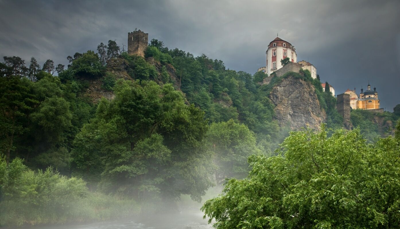
Visit the Vranov nad Dyjí Château, located in the western part of the Podyjí National Park, a national cultural heritage site. It offers visitors a tour of the authentic Baroque interiors of the Hall of Ancestors and the Chapel and also shows the estate culture at the Vranov Château in the late 18th and the 19th century.
- Author
-
The tour EV13 Stage 4: Drosendorf - Hardegg is used by outdooractive.com provided.


-
Waldviertel
86
-
Nationalparkregion Thayatal
37
-
Langau
12