© Gemeinde Gaweinstal

- Brief description
-
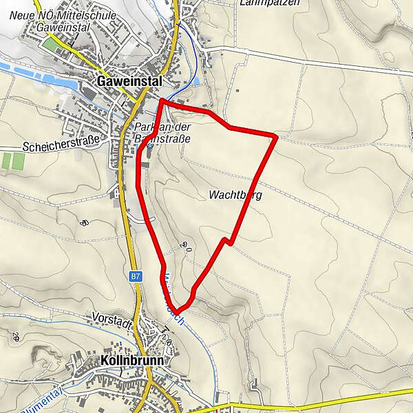
Start / Ziel: Gaweinstal
- Difficulty
-
easy
- Rating
-
- Route
-
GaweinstalKollnbrunn2.0 km
- Highest point
- 225 m
- Endpoint
-
Musikheim in Gaweinstal
- Height profile
-


- Author
-
The tour »tut gut« Wanderweg Gaweinstal | Route 1 is used by outdooractive.com provided.
GPS Downloads


General info
Refreshment stop
Other tours in the regions
-
Weinviertel
944
-
Leiser Berge
377
-
Gaweinstal
97