
- Brief description
-
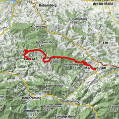
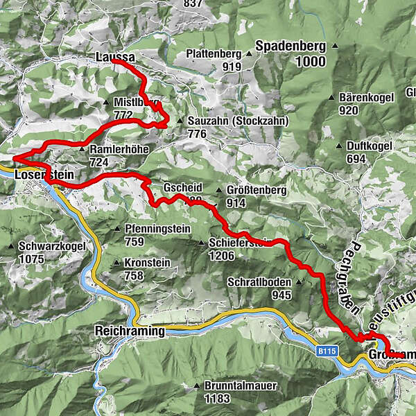
Starting point: Großraming
Stage destination: Laussa
Trail conditions: Hiking trail, asphalt, forest road
Trail length: 21 km
Metres in altitude: approx. 1,100 m (incl. Steinerner Jäger variant)
Großraming - Menweg - Gschoad - Stiedelsbach (Nagelschmiede) - Losenstein village square - Kirchenberg - Fatima Chapel - towards Sauzahn - Brettertal -Laussa. Variant: Steinerner Jäger (1,185 m)
- Difficulty
-
medium
- Rating
-
- Starting point
-
Großraming
- Route
-
Großraming0.0 kmPfarrkirche Großraming0.0 kmLandgasthof Kirchenwirt0.0 kmReingrub1.2 kmGscheid (780 m)8.0 kmCafé Restaurant Petermühle12.2 kmGasthof Marxrieser - Bräuhaus13.0 kmPfarrkirche hl. Blasius13.4 kmLosenstein13.5 kmLandesjugendhaus Losenstein13.9 kmEinsiedlerhöhle20.8 kmSchindlthal20.8 kmSchindlthalhöhle20.8 kmLaussa22.0 kmKirche Laussa22.0 km
- Best season
-
JanFebMarAprMayJunJulAugSepOctNovDec
- Description
-
Discovering along the way:
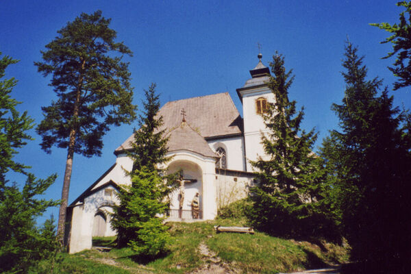
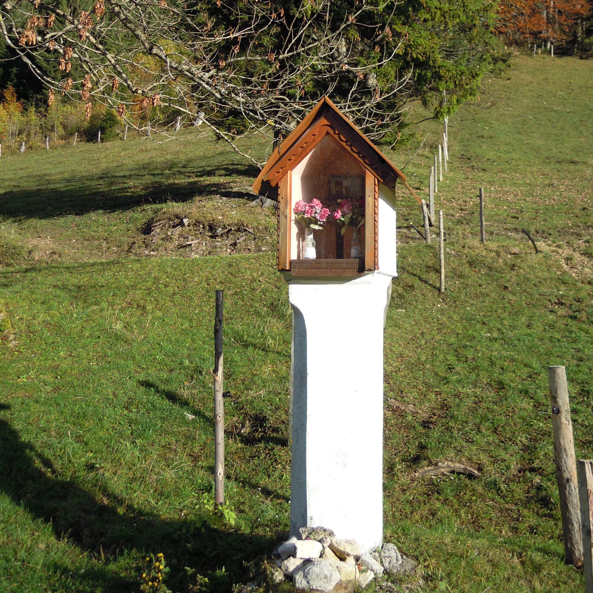
3 parish churches: Großraming (dedicated to St. James), Losenstein (dedicated to St. Blasius) and Laussa (dedicated to St. Mary) as well as several chapels.Off the beaten track:
Losenstein - indoor swimming pool, Blasibrunn Chapel, Laussa - Orchid Meadow nature reserve, sport climbing with over 180 routes on several crags situated in and around the village centre, including the famous "Sauzahn", THE climbing centre in the Enns Valley.Museums/Exhibitions:
Großraming carriage and cot museum, Losenstein nail smithy, castle or church tours, Heimatzimmer, Laussa collection of Stone Age finds at the municipal office, Mitterberg Troadkasten. - Directions
-
From the church square in Großraming, the trail leads a short distance west down to the round bridge and continues along the Menweg E65 to the Gschoad (Gscheid 782 m) below the Schieferstein. From the Gschoad, the trail leads via hiking trail E72 b into the Stiedelsbach, past the Nagelschmiede to the Petermühle inn and on to Losenstein. From the village square of Losenstein (church) the trail leads to the Kirchenberg, further on via hiking trail E74 to the Fatima Chapel and from there on towards Sauzahn. Before Sauzahn, at the old lime tree, turn left onto the Brettertal farm track down to Laussa.
Alternative: Sporty, experienced hikers can make a detour to the Steinernen Jäger (1,185 m) at Gschoad. Via hiking trail E72a you return to the Sebaldusweg.
- Highest point
- 786 m
- Endpoint
-
Laussa
- Height profile
-

- Equipment
-
Sturdy walking shoes, sun and rain protection, first aid kit for emergencies, possibly walking sticks.
- Safety instructions
-
As there are few opportunities to stop for refreshments directly along the trail, it is advisable to take enough snacks and drinks with you.
- Tips
-
Stop off on the way: Losenstein: GH Petermühle, Cafe Hohlrieder, GH Eisentor, Familiengasthof Blasl, Mostbrunnen am Kirchenberg; Laussa: Cafe-Bar Holzeck, Gasthaus "Zum Geiger".
- Additional information
- Directions
-
- From Salzburg/Linz: A1 motorway exit Enns-Steyr > B115 into the Enns Valley
- From Vienna: A1 motorway exit Haag > B42 > B122 > B115 into the Enns Valley
- From Passau: A8 Passau > Wels > A1 motorway exit Enns-Steyr > B115 into the Enns Valley
- From Graz: A9 Pyhrnautobahn > motorway exit Klaus > Grünburg > into the Ennstal valley
- Public transportation
-
The Ennstalbahn runs between Linz and Weißenbach-St. Gallen. Details at www.ooevv.atStations and railway stations are located in Steyr, Garsten, Lahrndorf, Dürnbach, Ternberg, Trattenbach, Losenstein, Reichraming, Großraming, Gaflenz, Weyer, Küpfern, Kastenreith, Kleinreifling and Weißenbach-St. Gallen.
- Parking
-
Großraming: Public parking spaces behind the regional music school or at the former Salzwimmer inn

- Author
-
The tour Sebaldusweg stage 01 | Großraming - Losenstein - Laussa is used by outdooractive.com provided.


General info
-
Traunviertel
1950
-
Steyr und die Nationalpark Region
1379
-
Reichraming
366