- Brief description
-
Comfortable hiking tour to the Reitalm in Hüttschlag.
- Difficulty
-
easy
- Rating
-
- Starting point
-
Parking lot Hebsanger
- Route
-
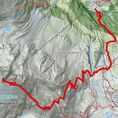
Reitalm3.5 km
- Best season
-
JanFebMarAprMayJunJulAugSepOctNovDec
- Description
-
From the parking possibility Hebsanger you hike along a forest road, first through the forest then through alpine meadows to the Reitalm (alternatively, you can also start directly from the center of Hüttschlag + 1 hour walking time). On the Reitalm the children awaits a huge playground with a lake and a petting zoo. The adults enjoy in the meantime a delicious snack with self-made prodcuts such as bread, butter, cheese, bacon or sausage. Of course, a schnaps shouldn't be missed.
- Directions
-
You go by car or hiking taxi to Hüttschlag and further to the parking possbility Hebsanger (way no. 44). Alternatively, you can also start directly from the center of Hüttschlag, which extends the walking time by 1 hour. From here you hike the way no. 44 to the Reitalm, 1,600 m (approx. 1 1/4 h). Back on the same route.
- Highest point
- 1,618 m
- Endpoint
-
Reitalm
- Height profile
-

- Equipment
-
hiking boots, hiking map
- Tips
-
There is a playground for children on the Reitalm. And you can reach this mountain hut also when it is raining.
- Additional information
- Directions
- Public transportation
- Parking
-
Hebsanger parking


- Author
-
The tour Hüttschlag: Reitalm is used by outdooractive.com provided.
GPS Downloads


General info
Refreshment stop
Flora
Other tours in the regions