- Brief description
-
Scenic theme trail in Unterlamm
- Difficulty
-
easy
- Rating
-
- Starting point
-
Centre of Unterlamm
- Route
-
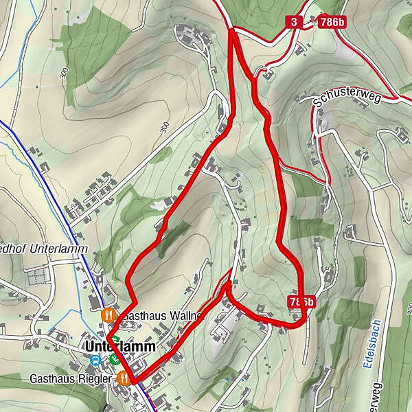
Unterlamm0.1 kmGasthaus Riegler0.1 kmLourdesgrotte0.2 kmGasthaus Wallner2.9 km
- Best season
-
JanFebMarAprMayJunJulAugSepOctNovDec
- Description
-
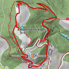
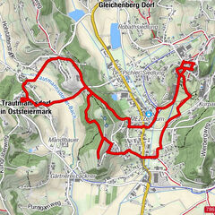
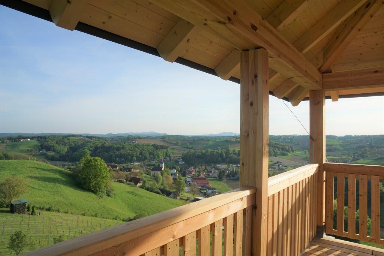
The ERLebenspfad Unterlamm is one of 3 new trails marked along 12 habitats.
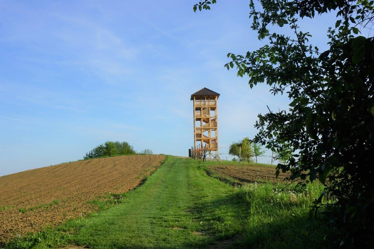
The view from the lookout point is characterised by numerous extensively managed meadows, the many near-natural hedges and the old, large orchards and is intended to inspire the exploration of all 12 habitats.
Nature conservation meadows are of great importance for the preservation of biodiversity and for the conservation of the natural and cultural landscape. A special feature are the recently planted old orchard varieties - each tree bears its own handmade clay tag. Old hedges can also be discovered in this area, which provide food and shelter for many birds, wild bees, butterflies, beetles, snakes and lizards. - Directions
-
Start: centre of Unterlamm - then follow the markings in the direction of the church - then always in the direction of the highest point - lookout point - the return route also always leads in visual contact with the finish / start centre of Unterlamm.
- Highest point
- 367 m
- Endpoint
-
Centre of Unterlamm
- Height profile
-

- Equipment
-
Smart backpack packing makes hiking life easier: always question the equipment - what do I really need? Pay attention to a balanced load distribution. Carry heavy items as close to your body as possible. Put things that are needed often - such as sunglasses, camera or hiking map - in the top lid compartment. Take enough liquids with you and stow them in a side pocket for easy access. Don't forget a snack or muesli bar for energy. Don't forget cash!
An emergency kit belongs in every rucksack! First aid kit, mobile phone with fully charged battery, hiking map or GPS device for orientation, small pocket knife.
Protection against heat and cold - it is always advisable to dress according to the "onion system"! Cap, sun cream & sunglasses, thin cap, change of clothes, rain jacket.
A good hiking boot is a perfect companion and should never be missing! Don't forget blister plasters just in case!
If necessary, hiking poles are recommended! - Safety instructions
-
Emergency call fire brigade: 122
Emergency call police: 133
Emergency call rescue: 144
Euro emergency call: 112 - Tips
-
Picnic on the lookout - enjoy the sunrise or sunset
- Additional information
-
Municipality of Unterlamm
8352 Unterlamm 100
Phone: +43 3155 8208
gde@unterlamm.gv.at
www.unterlamm.gv.at - Directions
- Public transportation
-
Detailed information about arriving by ÖBB (Austrian Federal Railways) can be found at www.oebb.at or on the Verbundlinie Steiermark website www.busbahnbim.at.
With Verbundlinie’s BusBahnBim route planner app, planning your journey has never been easier: simply enter towns and/or addresses, stop names or points of interest to check all bus, train and tram connections in Austria. The app is available free of charge for smartphones – on Google Play and in the App Store.
- Parking


- Author
-
The tour Experience path Unterlamm (ERLebenspfad Unterlamm) is used by outdooractive.com provided.


General info
-
Thermen- & Vulkanland
1324
-
Loipersdorf bei Fürstenfeld
463
-
Unterlamm
171