
- Brief description
- Starting point
-
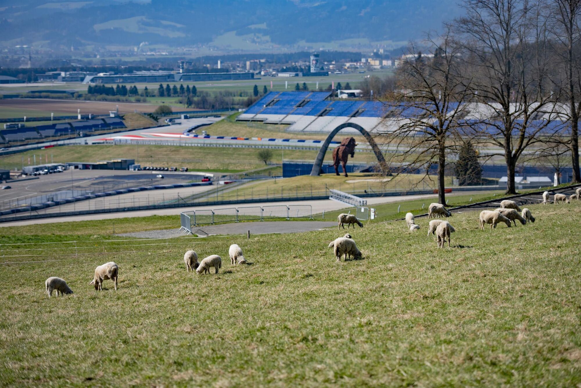
Schönberg Church above the Red Bull Ring in Spielberg
- Route
-
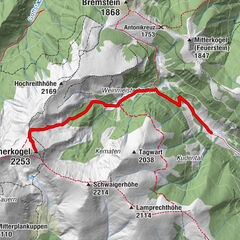
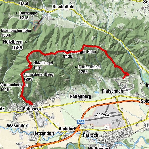
Schönberg0.1 kmAdlerkuppe (1,267 m)3.6 kmFlatschacher Höhe (1,323 m)5.4 kmRattenberger Höhe (1,430 m)7.5 kmZwieselberg (1,534 m)9.5 kmHölzelkogel (1,451 m)11.0 kmFohnsdorfer Berg (1,299 m)12.6 kmFohnsdorf16.3 km
- Best season
-
JanFebMarAprMayJunJulAugSepOctNovDec
- Description
-
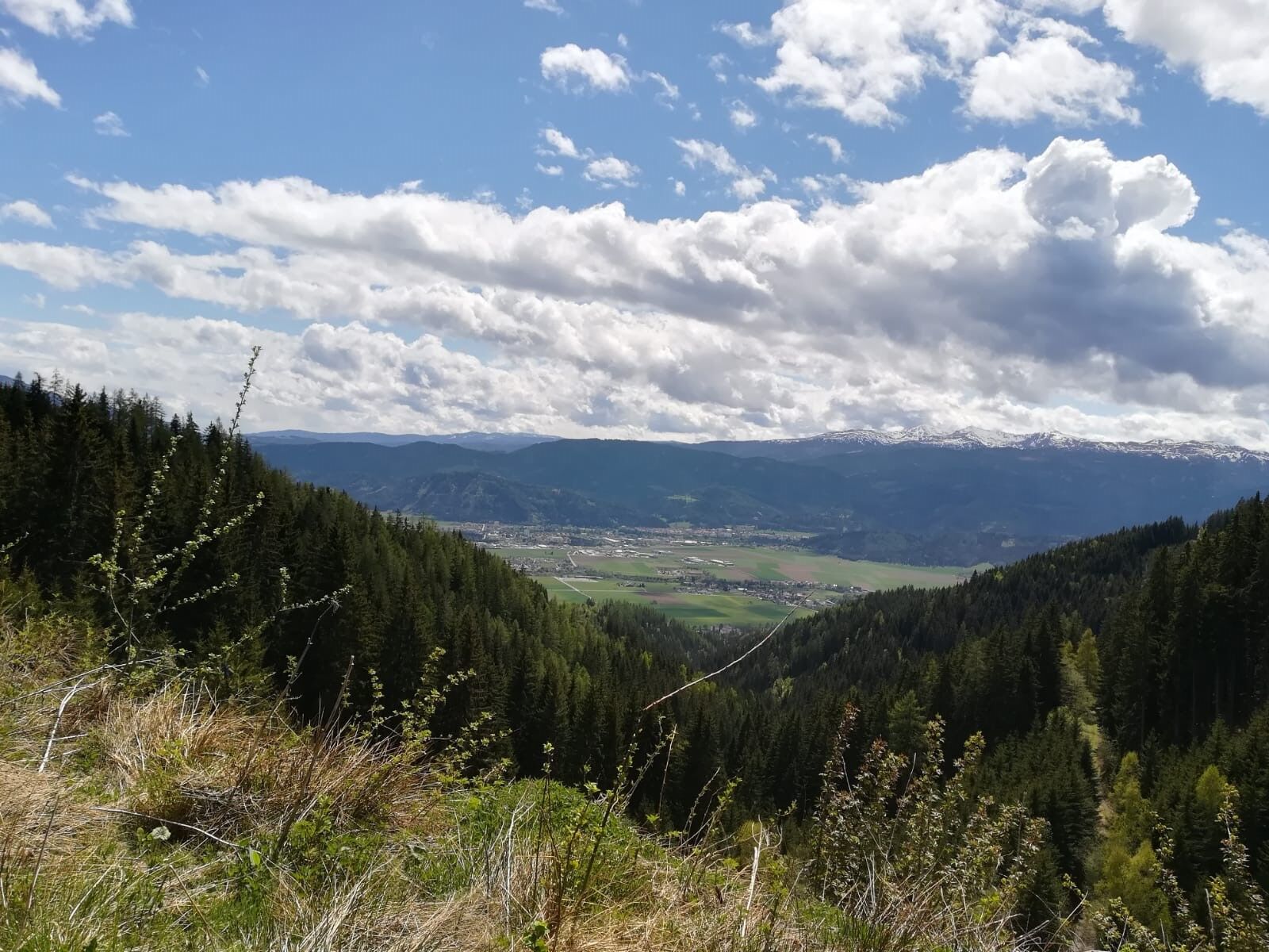
On this tour, our mountain expert Martin takes us on the panoramic ridge hike starting above the Red Bull Ring to Fohnsdorf in the murtal adventure region. We hike on the Rattenberger Höhe on forest paths and meadows and have a great view to the north to the Großer Ringkogel, Pletzen, Geierhaupt, Hochreichart, Maierangerkogel, the Seckauer Zinken and to the Hochalm. Our hike takes us in the direction of Zwieselberg to the highest point of our tour (1,534 metres) and enjoy the view of the Mur valley and the Größing to the south as well as the Zirbitzkogel. At the "Gstättner" we reach the "Gstättnerweg" and follow it to our tour destination in the municipality of Fohnsdorf.
- Directions
-
Now to the route description and hike report by our mountain fex Martin - www.bergfexmartin.at
The starting point for our tour is the car park at Schönbergkircherl, just above the Red Bull Ring. We follow the road to the left past the church and soon reach the first signpost. Trail 988 takes us further into the forest, where we follow well-marked paths that are always visible. In between, the path climbs, so we gain more than 500 metres in altitude before reaching our first summit. The path to the Adlitzkuppe, or Adlerkuppe, is not on the "main trail 988", but with a little map study or using the GPS track on your mobile phone you can find it without any problems. We take a short break and enjoy the warming sun, it was still quite fresh in the shady parts of the forest.
Then we continue our tour in the direction of Flatschacher Höhe. After a few moments, a fantastic view of the main ridge of "my Seckauer Tauern" presents itself to our right. Cloudless, the peaks still covered in snow - for minutes we enjoy the views of the Großer Ringkogel, Pletzen, Geierhaupt, Hochreichart, Maierangerkogel, the Seckauer Zinken and the Hochalm - next summer is sure to come! The trail from the Adlitzkuppe is partly free of snow and always climbs gently, but it only becomes as steep as it was on the first few kilometres on the ascent to the Zwieselberg. We continue along forest paths and open grassy areas and reach the Flatschacher Höhe at 1,363 metres shortly before noon, from where we have a fantastic view of the Aichfeld and the Größing to the south. After a somewhat longer break including drone flights, we continue our hike in the direction of the Rattenberger Höhe. (Attention: if you want to fly with your drone in this region, you have to get this geo-zone unlocked beforehand!)
After a leisurely hour with many photo stops, we stand on the Rattenberger Höhe, but immediately march on towards Zwieselberg, the highest point of our tour at 1,534 metres. We reach it shortly before half past two in the afternoon. The last few metres up to the summit are particularly hard on the "calves". Here, too, we don't linger long and follow trail 988 in a westerly direction. After about ten minutes we come to a "crossroads", where we decide to descend on trail 993, via the "Gstättner" farm. From here, we could also hike on to the Gaalerhöhe and the Fohnsdorferhütte. We trudge for a few minutes through stubbornly persistent snowfields and a little later tackle the last metres of altitude of the day, because we now have to climb the beautifully situated Hölzelkogel. I can't leave my camera in my rucksack there, the weather and the views are too beautiful.
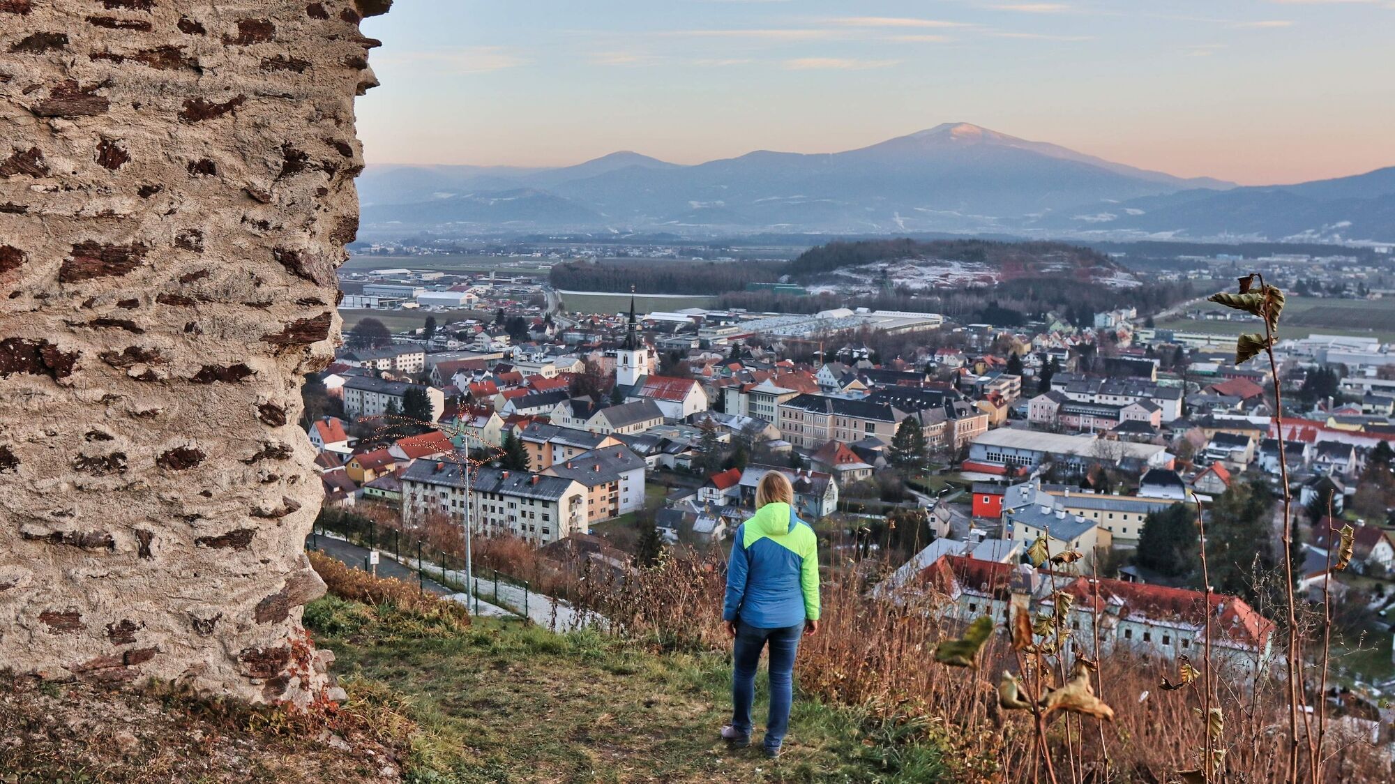
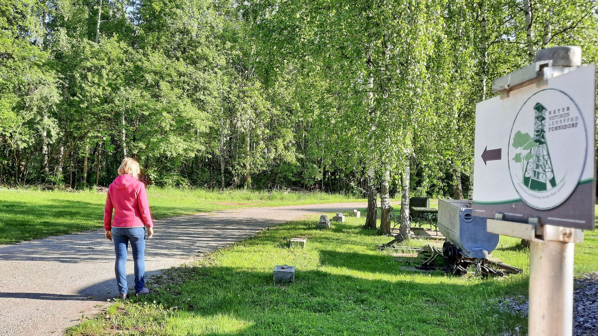
A few metres below the Hölzelkogel we reach a forest path, which we now follow. The descent via trail 993 is always perfectly marked and partly leads down steep slopes. At the "Gstättner" we reach the "Gstättnerweg" and follow it to our tour destination - the community of Fohnsdorf with its 8,000 inhabitants. On this day we let ourselves be "chauffeured" back to the starting point - we are happy to spare ourselves the nine kilometre asphalt hike.
- Highest point
- 1,530 m
- Endpoint
-
Fohnsdorf Gstättnerweg, near the Fohnsdorf Ruin
- Height profile
-

- Equipment
-
Day hiking backpack (approx. 20 liters) with rain cover, sturdy and comfortable shoes, weather appropriate and durable clothing in a multi-layer principle,
telescopic poles if necessary, sun and rain protection, provisions and drinking water, pocket knife, cell phone, headlamp if necessary, maps.
Good hiking shoes protect and relieve the foot and improve surefootedness! When choosing, make sure they fit perfectly, have a non-slip treaded sole, are waterproof and lightweight.
Adapt your equipment to your hike and make sure your backpack is lightweight. Nevertheless, rain, cold and sun protection always belong in your backpack, as well as a first aid kit and cell phone (Euro emergency call 112). Map or GPS support the orientation.
Translated with www.DeepL.com/Translator (free version)
- Safety instructions
-
Falls, as a result of slipping or tripping, are the most common cause of accidents! Note that excessive speed or fatigue will severely affect your surefootedness and concentration.
Alpine emergency call:
Mountain rescue emergency number: 140
EU emergency number: 112
Weather service:
www.zamg.ac.at
Direct link mountain weather Styria:
https://www.zamg.ac.at/cms/de/wetter/produkte-und-services/bergwetter/steiermark
- Tips
-
At the "Gstättner" farm, you could also hike on to the Gaalerhöhe and the Fohnsdorferhütte (from May to the end of September, the Fohnsdorfer Hütte is open at weekends!). Possibly organise a pick-up from the destination to the starting point in advance.
- Additional information
-
You can find these and other tours by our mountain expert Martin at: https://www.bergfexmartin.at
Fohnsdorferhütte: https://fohnsdorferhuette.naturfreunde.at/
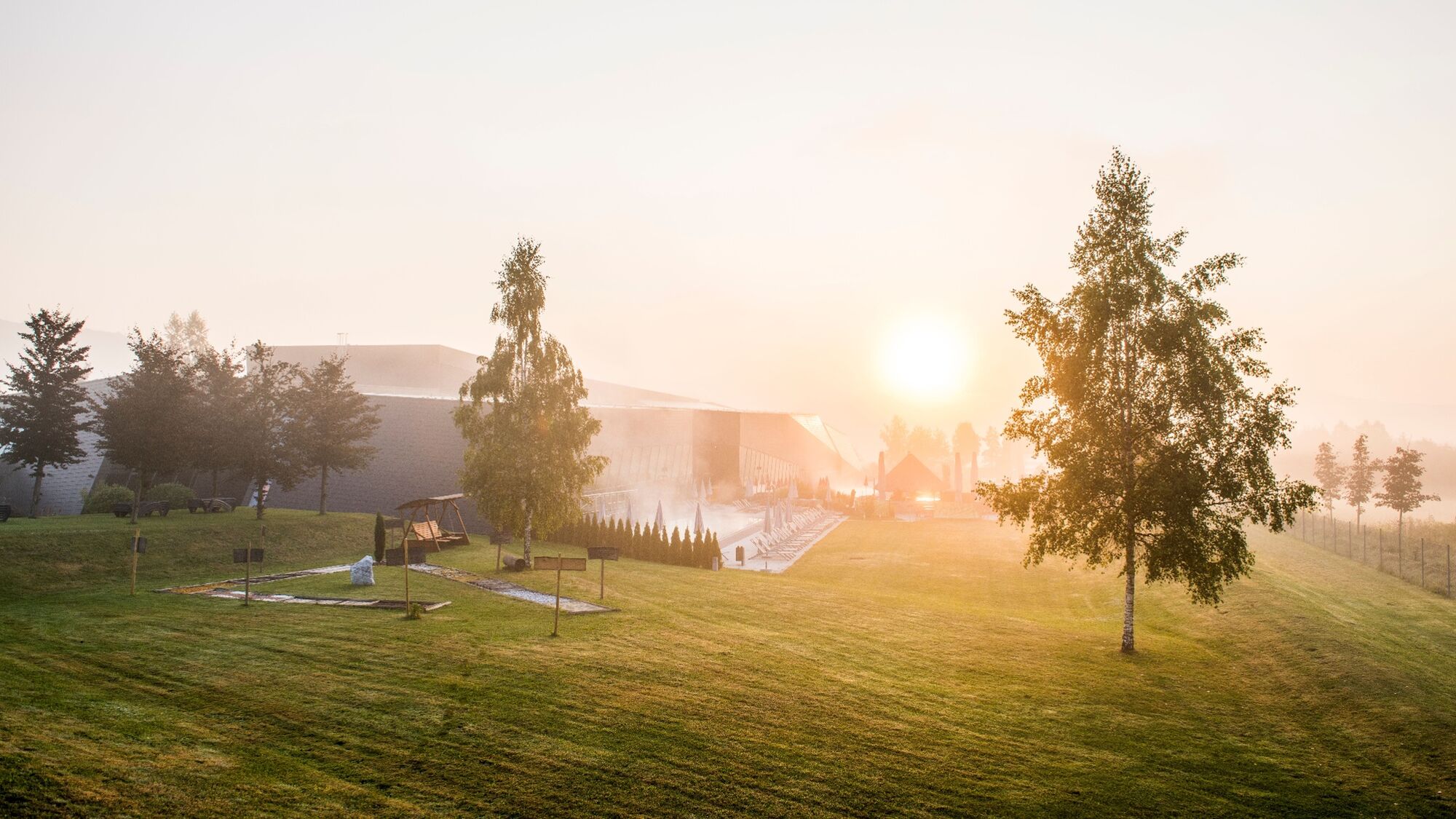
Therme Aqualux: https://www.therme-aqualux.at/
Burgruine Fohnsdorf: http://www.burgenseite.com/unknown/fohnsdorf_txt.htm
Red Bull Ring Spielberg: https://www.projekt-spielberg.com/de/der-spielberg/red-bull-ring
Wanderkarten :
Spielberg - Wanderkarte 1 - Seckauer Alpen/Seetaler Alpen - Tour 25
Spielberg - Wanderkarte 2 - Gleinalpe/Stubalpe - Tour 25
Diese Karten erhalten Sie gratis beim Tourismusverband "Tourismus am Spielberg" - info@tourismus-am-spielberg.at - Tel.: 0043 664 3577 2022 7166
Weitere Informationen zur Erlebnisregion Murtal finden Sie außerdem auf -oder im Gratis App der Urlaubsregion Murtal
- Directions
-
On the S36 we take the exit Zeltweg Ost to the Red Bull Ring, directly along the race track we drive up the Spielberg to the small Schönberg church.
On the S36, take the Judenburg Ost exit to Fohnsdorf to the main square where the Grabenstrasse begins to climb slightly.
- Public transportation
-
Take the train to Knitttelfeld and then the Aichfeld bus to Flatschach or the Red Bull Ring bus stop.
Aichfeldbus: https://www.verbundlinie.at/images/service/pdfs/liniennetz/aichfeld.pdf
https://verkehrsauskunft.verbundlinie.at/?language=de_DE&P=TP&S=Knittelfeld%20Bahnhof&Z=Spielberg%20(Stmk)%20Red%20Bull%20Ring&start=yes&widget=1.0.0&
- Parking
-
Parking at Schönbergkircherl above the Red Bull Ring near Landhotel Schönberghof.
Fohnsdorf: There are a few parking spaces available in Grabenstraße and more free of charge at the stadium without time limit.

- Author
-
The tour Panoramic tour from the Red Bull Ring to Fohnsdorf is used by outdooractive.com provided.


General info
-
Erlebnisregion Murtal
1793
-
Steirisches Zirbenland
708
-
Fohnsdorf
190