- Brief description
-
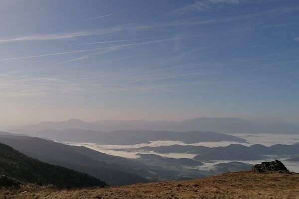
A wonderful running course with only a few metres of altitude and a beautiful route.
- Difficulty
-
medium
- Rating
-
- Starting point
-
Kurpark Bad Gams
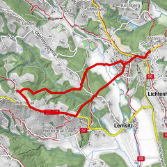
- Route
-
Bad GamsMüllegg0.4 kmMitteregg1.3 kmNiedergams4.5 kmBergegg6.5 kmDirnberg6.9 kmKapelle8.6 kmFurth8.7 kmBad Gams9.9 km
- Best season
-
JanFebMarAprMayJunJulAugSepOctNovDec
- Description
-
The route leads mostly on forest paths through mixed forests. Fresh air and a beautiful landscape characterise this route around Bad Gams.
- Directions
-
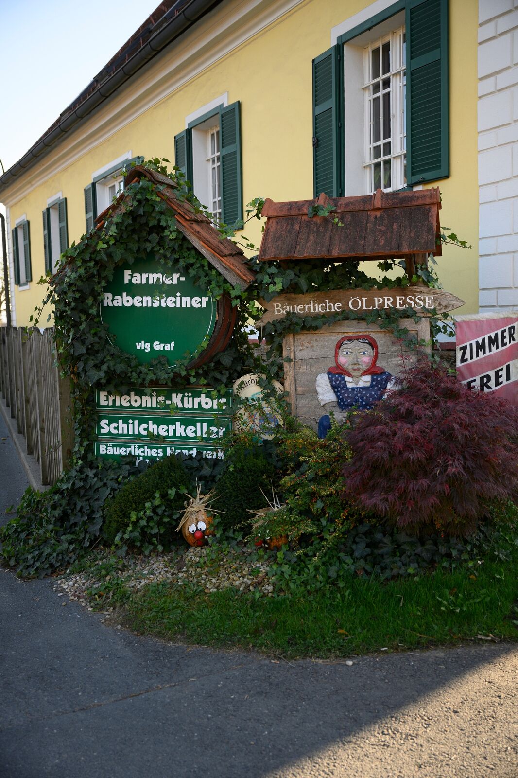
Get ready for this beautiful and varied 10 kilometre run. You start your lap at the Bad Gams spa gardens. Why not warm up in the park? The playground on site can be a good help. Now you can start your lap. Walk in the direction of the Gesundheitshotel Kipper. Keep to the right and continue through Müllegg. After the residential area, leave the road and walk right along a field path to the Mühlen-Museum. Follow the L643 for a short distance and after 100 metres turn right onto the field path. Continue at a brisk pace until you reach Gersdorf. On these 2.3 kilometres you will run through fields and forests. With a bit of luck, you might even spot forest animals. As soon as you feel the asphalt under your feet, continue straight ahead for a while. At the crossroads, take the field path on your right. You pass through Gersdorf and continue straight on at the crossroads in Niedergams. At the end of the small settlement area, take the access road to the right - which leads you onto a forest path. Walk along this natural forest path until you reach Bergegg. Take deep breaths and enjoy the fresh forest air. When you arrive in Bergegg, a crossroads awaits you. Take the ashpahlt road to the right. Keep left at the first fork and then right at the next. As soon as you see residential buildings on your left, walk to the right through the forest. After 300 metres of forest path you are back on the road. Follow this road until you reach Furth. You will now see the Farmer Rabensteiner vlg. Graf. This is always worth a visit. You can expect rural handicrafts, award-winning vinegar and oil products, a ceramics room, as well as a gourmet and culinary room. After the Genusswelt Farmer Rabensteiner, take the second road to the left. A path now leads you along the Gamsbach stream, enjoy the quiet babbling of the stream. You will pass the Gamsbad with its lakeside restaurant, where you can also play tennis if you wish, and return directly to the starting point.
- Highest point
- 457 m
- Endpoint
-
Kurpark Bad Gams
- Height profile
-

- Equipment
-
Running shoes and seasonal running clothes.
- Safety instructions
-
Suitable running clothes are an advantage.
Rescue: 144
Emergency reporting tip - give answers to the six W questions: What happened? How many injured? Where did the accident happen (possibly GPS coordinates)? Who reported the accident (call-back number)? When did the accident happen? Weather at the accident site?
- Tips
-
The Bad Gams sports and leisure centre offers a wide range of sports facilities. Swimming, tennis and beach volleyball.
- Directions
-
Plan your journey via Google Maps to the starting point of the tour: www.google.at/maps
From the north: Motorway Munich - Salzburg - Eben - Schladming - Liezen onto the A9 towards Graz. Exit at Lieboch and follow the B76 towards Deutschlandsberg. In Stainz leave the B76 at the JET petrol station at the first exit from the roundabout, turn left at the crossroads to Bad Gams. A9 is subject to toll - Gleinalmtunnel. Alternative: at St. Michael take the S6 towards Bruck and in Bruck take the S35 towards Graz.
From the west: In Villach take the A2 towards Klagenfurt. Exit at Steinberg and drive towards Stainz, from there along the B76 towards Deutschlandsberg. In Stainz leave the B76 at the JET petrol station at the first exit from the roundabout, turn left at the crossroads to Bad Gams.
From the east: A2: Vienna - Aspang - Hartberg - Fürstenfeld - Graz. From Graz continue on the A2 in the direction of Klagenfurt and take the Lieboch exit in the direction of Stainz/Deutschlandsberg/Eibiswald. Follow the B76 to Deutschlandsberg. In Stainz leave the B76 at the JET petrol station at the first exit from the roundabout, turn left at the crossroads to Bad Gams.
From the south: A1 from Marburg to Leibnitz. Exit in Leibnitz (Gralla) and continue on the B74 in the direction of Deutschlandsberg (Heimschuh - Gleinstätten - St.Martin - Deutschlandsberg). Pass the LKH Deutschlandsberg, at each of the four roundabouts take the second exit in the direction of Stainz-Graz. After the fourth roundabout on the B76, take the turning lane to the left in the direction of Bad Gams.
- Public transportation
-
You can find timetables and travel information directly at
With the BusBahnBim app of the Verbundlinie, timetable information is easier than ever: all connections by bus, train and tram in Austria can be retrieved by entering places and/or addresses, stops or important points. The app is available as a free app for smartphones (Android, iOS) - on Google Play and in the App Store.
- Parking

-

-
AuthorThe tour Around Bad Gams - Run is used by outdooractive.com provided.