Tour data
11.32km
457
- 1,506m
1,246hm
384hm
06:23h
- Brief description
-
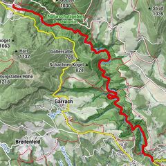
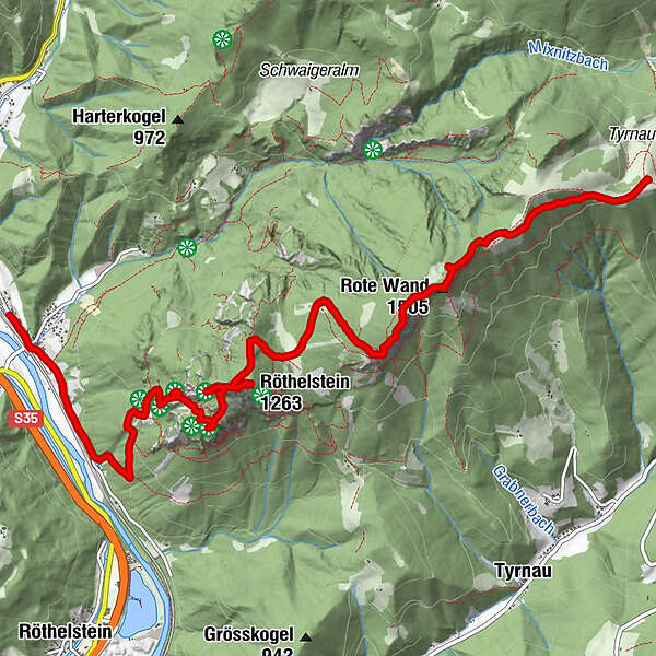
Bahnhof Mixnitz-Röthelstein-Rote Wand- Thyrnauer Alm-Bahnhof Mixnitz
- Difficulty
-
medium
- Rating
-
- Route
-
Mixnitz0.2 kmHeubergerstüberl1.1 kmDrachenhöhle (950 m)3.8 kmRöthelstein (1,263 m)5.7 kmBucheben (1,081 m)6.8 kmGipfelkreuz Rote Wand9.0 kmRote Wand (1,505 m)9.0 kmTyrnauer Almhütte11.2 km
- Highest point
- 1,506 m
- Endpoint
-
Da ich keinen Speicherplatz mehr für das Tracking hatte fehlt der Schlussteil von der Thyrnauer Alm zurück zum Bahnhof Mixnitz. Das sind relativ einfache 2,5 Stunden ohne Gegenanstieg im gemütlichen Tempo
GPS Downloads


Trail conditions
Asphalt
Gravel
Meadow
Forest
Rock
Exposed
Other tours in the regions
-
Erlebnisregion Graz
2812
-
OberGraz
1738
-
Mixnitz
445