© Julia Leitner - Alpbachtal Seenland Tourismus
Tour data
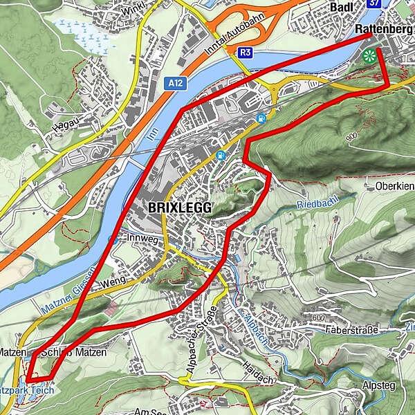
11.4km
513
- 763m
-
04:00h
- Brief description
-
Wanderung mit kulturellem Anspruch
- Rating
-
- Starting point
-
Parkplatz beim Schloss Lipperheide (Eingang zum Matzenpark)
- Highest point
- 763 m
- Rest/Retreat
-
Restaurants/Cafés im Matzenpark, Mehrn und Rattenberg
- Ticket material
-
Mayr Wanderkarte Alpbachtal & Tiroler Seenland

GPS Downloads


Trail conditions
Asphalt
Gravel
Meadow
Forest
Rock
Exposed
Other tours in the regions
-
Alpbachtal
1504
-
Brixlegg
501