

© Bregenzerwald Tourismus GmbH - Cornelia Kriegner

© Bezau Tourismus - Lisa Kaufmann

© Vorarlberg Tourismus GmbH - Bregenzerwald Tourismus GmbH

© Bezau Tourismus - Lisa Kaufmann

© Bregenzerwald Tourismus - Cornelia Kriegner

- Brief description
-
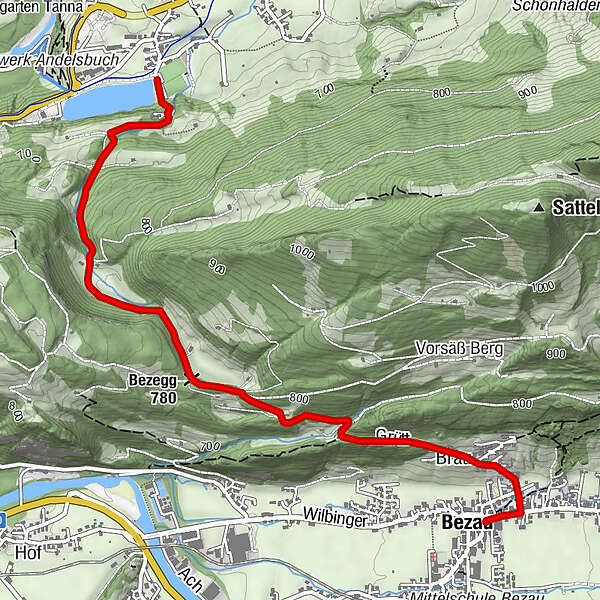
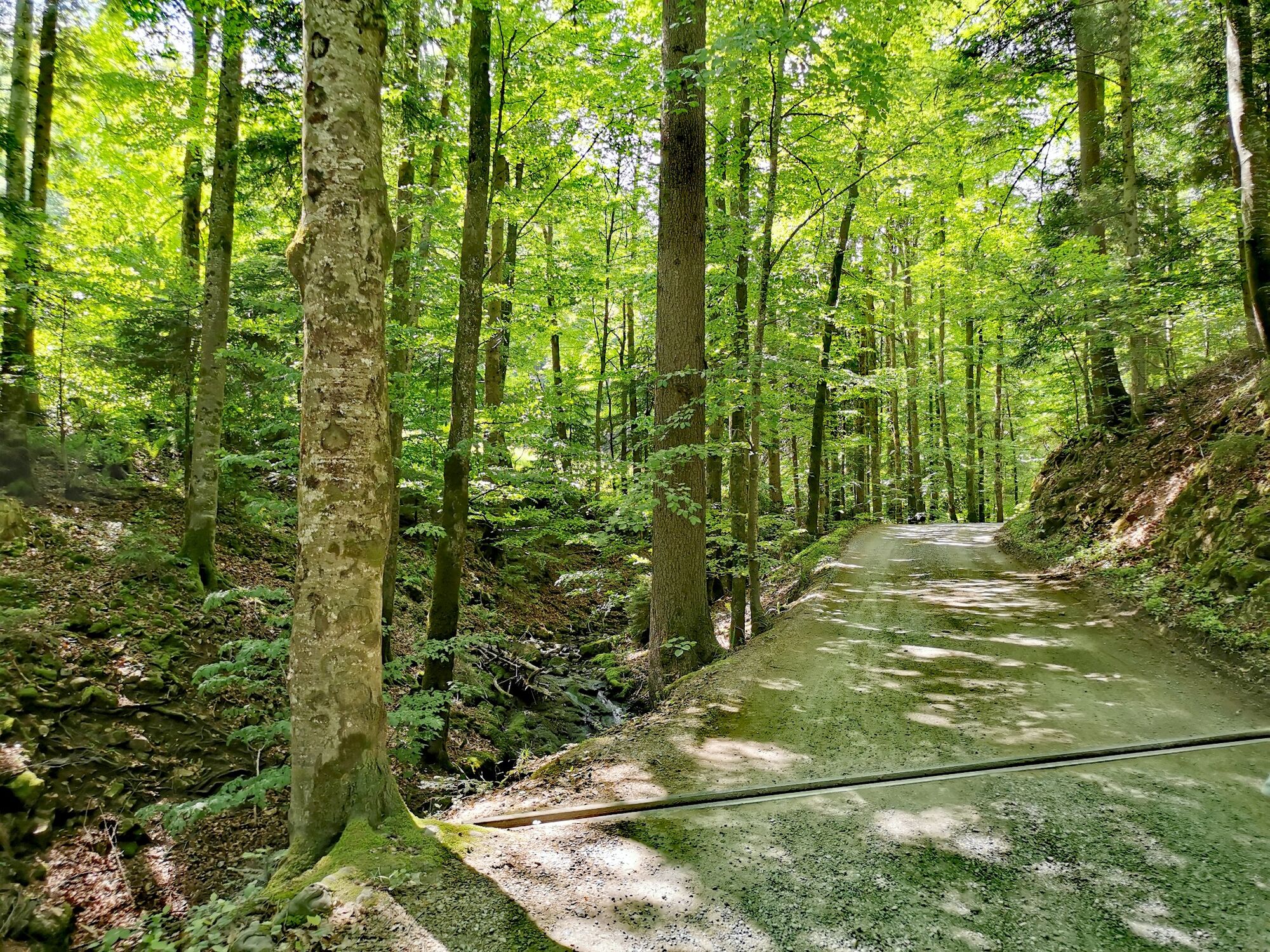
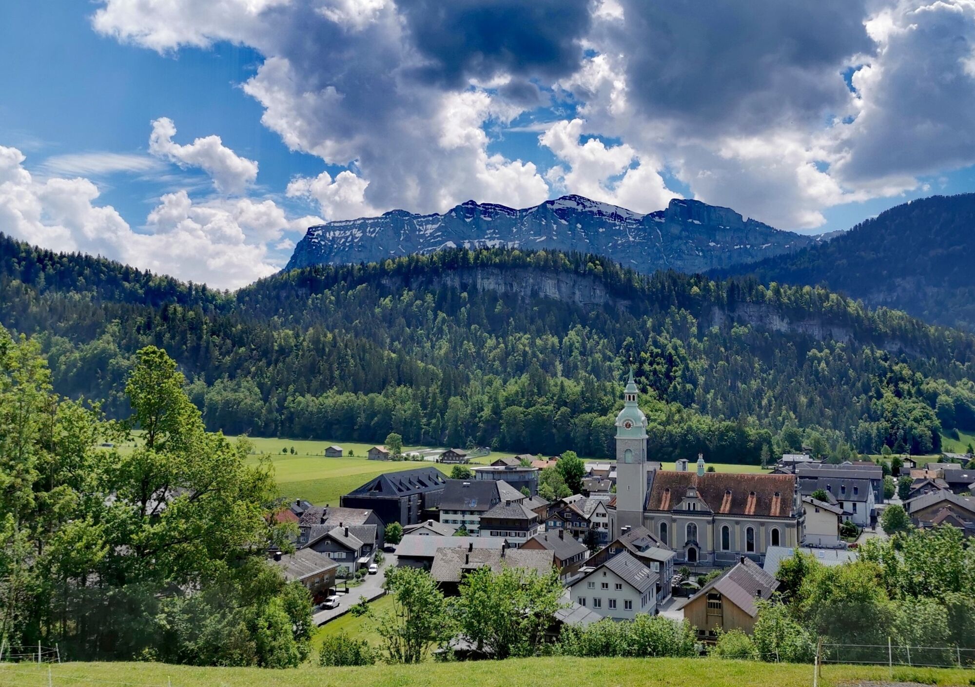
Schöne Wanderung über die alte Landstraße nach Andelsbuch. Der Weg führt über die Bezegg - vorbei an der Bezeggsul bis zum Stausee Andelsbuch.
- Difficulty
-
easy
- Rating
-
- Route
-
BezauSt. Jodokkirche0.0 kmGasthof Engel0.0 kmBrau0.5 kmBezegg (780 m)1.9 km
- Best season
-
JanFebMarAprMayJunJulAugSepOctNovDec
- Highest point
- 787 m
- Endpoint
-
Stausee Andelsbuch
- Height profile
-

- Author
-
The tour Bezau | Bezegg - Andelsbuch is used by outdooractive.com provided.
GPS Downloads


General info
Cultural/Historical
A lot of view
Other tours in the regions
-
St. Gallen - Bodensee
2070
-
Bregenzerwald
2347
-
Andelsbuch
676


