2012
NU0842 : A refuge hut on Lindisfarne Causeway
taken 12 years ago, near to Beal, Northumberland, England
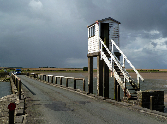
A refuge hut on Lindisfarne Causeway
Holy Island is linked to the mainland by a long causeway where twice each day the incoming tide covers the road. Safe crossing times are displayed for motorists but when drivers get caught out they can take refuge here and be rescued or wait for the next low tide. I used the shelter when a heavy shower passed over but left when I realised that a swallow had built a nest inside and was waiting to come in and feed the young birds.
 Map © Crown Copyright")
TIP: Click the map for more Large scale mapping
- Grid Square
- NU0842, 282 images (more nearby 🔍)
- Photographer
- Walter Baxter (more nearby)
- Date Taken
- Wednesday, 22 August, 2012 (more nearby)
- Submitted
- Saturday, 25 August, 2012
- Subject Location
-
OSGB36:
 NU 0858 4288 [10m precision]
WGS84: 55:40.7601N 1:51.9075W - Camera Location
-
OSGB36: NU 0859 4288
- View Direction
- WEST (about 270 degrees)