

Vorderstoder - Hirschmauer


- Suitable for families
- Suitable for kids (all ages)
Interactive elevation profile
Create PDF
Tour-Details
Starting place: 4574 Vorderstoder
Destination: 4574 Vorderstoder
duration: 2h 41m
length: 5,0 km
Altitude difference (uphill): 557m
Altitude difference (downhill): 186m
Lowest point: 785m
Highest point: 1.189m
difficulty: easy
condition: medium
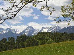
panoramic view: Great panorama
Paths covering:
Hiking trail
powered by TOURDATA
This path is marked from the place (Steinerstadel). But you can also get on at the Hubertus Chapel in Vorderramseben.
After 50 m turn right into Forstrasse, shortly afterwards the Hirschmauer hiking trail turns right. A beautiful forest path now leads with a forest road crossing to a Bründl and a nice rest area. From here you have a beautiful view of the small creek and the Dead Mountains. A short distance further along the path, then you come out on the forest road, turn left and at the next crossroads you also go left. After approx. 100 m, pay attention to the Hirschmauer junction, it shows the way to the lookout point. A panorama board provides information about the names of the mountains and farms. Please take care of your children, there are steep precipices!
After 50 m turn right into Forstrasse, shortly afterwards the Hirschmauer hiking trail turns right. A beautiful forest path now leads with a forest road crossing to a Bründl and a nice rest area. From here you have a beautiful view of the small creek and the Dead Mountains. A short distance further along the path, then you come out on the forest road, turn left and at the next crossroads you also go left. After approx. 100 m, pay attention to the Hirschmauer junction, it shows the way to the lookout point. A panorama board provides information about the names of the mountains and farms. Please take care of your children, there are steep precipices!
Starting point: Steinergut
Destination: Hirschmauer
- Suitable for kids (all ages)
- Suitable for teenagers
- Suitable for seniors
- Suitable for single travelers
- Suitable for friends
- Suitable for couples
- Suitable for children
- Spring
- Summer
- Autumn
- Early winter
Please get in touch for more information.
4574 Vorderstoder
Phone +43 7564 8255
E-Mail vorderstoder@pyhrn-priel.net
Interactive elevation profile
Create PDF
Tour-Details
Starting place: 4574 Vorderstoder
Destination: 4574 Vorderstoder
duration: 2h 41m
length: 5,0 km
Altitude difference (uphill): 557m
Altitude difference (downhill): 186m
Lowest point: 785m
Highest point: 1.189m
difficulty: easy
condition: medium
panoramic view: Great panorama
Paths covering:
Hiking trail
powered by TOURDATA