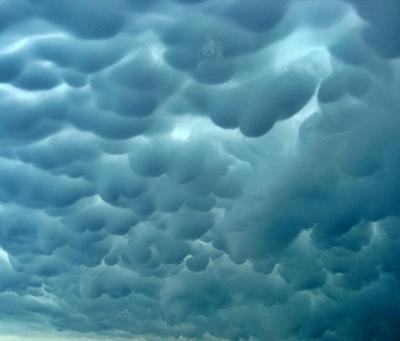
Mammatus clouds are most often associated with the anvil cloud that extends from a cumulonimbus, but may also be found under altocumulus, altostratus, stratocumulus, and cirrus clouds, as well as volcanic ash clouds.
These clouds often accompany severe thunderstorms, but do not produce severe weather; they may also accompany non-severe storms as well.
Sometimes very ominous in appearance, mammatus clouds are harmless and do not mean that a tornado is about to form, which is a commonly held misconception. In fact, these clouds are usually seen after the worst of a thunderstorm has passed.
As an updraft carries precipitation enriched air to the top of a cloud, the upward momentum is lost and the air begins to spread out horizontally, becoming a part of the anvil cloud in the thunderstorm.
Due to its high concentration of precipitation particles (ice crystals and water droplets), the saturated air is heavier than the surrounding air and sinks back toward the earth. The subsiding air eventually appears below the cloud base as rounded pouch-like structures called mammatus clouds.